The most beautiful hike from Melag
The most famous hike in the Langtauferer Valley

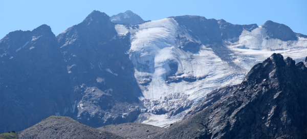



The Langtauferer Tal is one of the most visited valleys of the Ötztal Alps on the Italian side of the mountain range. The most famous starting point is the highest village in the valley – Melag. From there, he sets off on the most beautiful local hike to the Weißkugelhütte mountain hut. There are several ways to do this circuit, so you don't have to go back the same way.
Hike Melag - Melageralm
A short walk in the Langtauferer Tal
The Langtauferer Tal is one of the most beautiful valleys of the Ötztal Alps. You will find it on the Italian side of the mountain range. The best tourist starting point in the valley is Melag (1,898m) located at the end of the mountain road at an altitude of almost two thousand meters above sea level. A short, comfortable walk from here leads to the Melageralm mountain hut (1,973m), which can be a trip destination for a family with small children, or a „starting point“ for the rest of the hike. continue reading


Hike Melageralm - Weißkugelhütte
Ascent to the iconic mountain cottage
If the walk from Melag to the Melageralm was just a walk for small children, then the subsequent ascent to the Weißkugelhütte mountain hut will certainly warm you up. Although it is only 3.5 kilometers, you will have to climb 600 meters in height. As you increase in height, you will have beautiful views of the surrounding mountains, including the massive Weisskugel peak (3,738m), which is the most important destination for climbers in this area. continue reading

Hike Weißkugelhütte - Melag
Hike on the viewing balcony
After enjoying the beautiful views around the Weißkugelhütte mountain hut, you will most likely be on your way back to Melago. If you went towards the cottage by the path leading through the valley, it is far better not to return with the same path, but to choose an alternative descent via a scenic path high up in the valley. Instead of zigzags, a gentler descent awaits you (the steeper part is almost at the end near Melag). The descent path is only about 5 km long and you will drop 650 meters in height. continue reading