Hike through Upper Khangsar
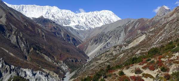
Beautiful view of the Marsyangdi valley


For tourists returning from a trip to Lake Tilicho is much more practical and moreover even nicer not to go the same way back to Manang, but to go along the top route through the village of spirits – Upper Khangsar and then go down directly to Yak Kharka through the beautiful small outlook cliff high above the river valley. In addition, this path is the least often walked by the tourists trekking around Annapurnas.
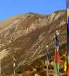
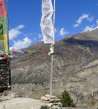
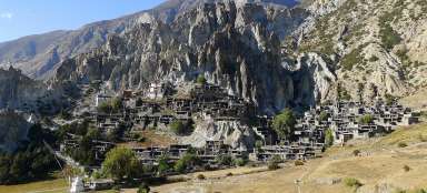
Upper Khangsar
After more than two hours hike from Tilicho Base Camp back in the direction to Manang you arrive at a newly built Lodge (4070 m asl) – ideal for a tea break. Just 200 meters behind it there is a crossroad, where from the main path turns a footpath to Upper Khangsar. From this point begins this photoreport. The path traverses the slope and slowly rises. Along the way there is a beautiful view of the whole valley, icy ridge and interesting mountain of Phra Idam (5875 m asl). After half an hour Upper Khangsar (4120 m asl) finally appears. It looks like a ghost’s village, because there are quite a lot houses, but you do not meet a soul here.

Small fields near Upper Khangsar
A bit confusing is newly built wide path, not drawn on the maps, leading off somewhere to the hills. But the correct way is in the northeast direction along the edge of small fields. Along the way there is also a beautiful view of the Gangapurna and Annapurna III. Since it is the view to the southeast direction, it is difficult to take photos of the giants here, because they are most of the day against the sun.

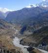
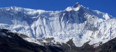
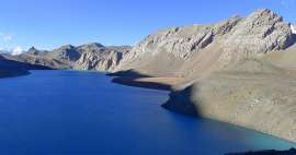
View of Manang
After about an hour's walk from Upper Khangsar you come to the top of this shortcut – small cliff (4150 m asl) with superb views of the Marsyangdi valley. From here you can beautifully see the confluence of the rivers and the lower path to Khangsar and further to Lake Tilicho. Annapurna II.dominates the horizon in the south and Pisang peak in the north. Directly opposite across the side valley winds the main path in the direction to Thorong Phedi.

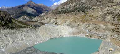
Thorong Khola valley
View to the north to the arid valley of Thorong Khola is unpleasing. You can see how the path from the small cliff at the beginning sharply and later more gradually decreases up to the confluence (3,850 m asl) of Thorong Khola with Ghyanchang Khola flowing from the massif of Chulu. It's a loss of more than 300 altitude meters. It can be clearly seen, how the main path from Manang goes quite away into the side valley. But it does not lose any altitude meters anyway.

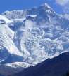
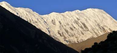
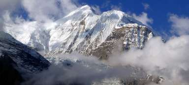
Gangapurna
Gangapurna looks quite interesting from the small cliff. Very surprising is that virtually nobody goes that way and girls from Khangsar have a little refreshment tent here. It is advisable to use their services, because the way to Yak Kharka or even farther to the Ledar is still long.

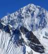
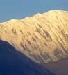
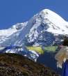
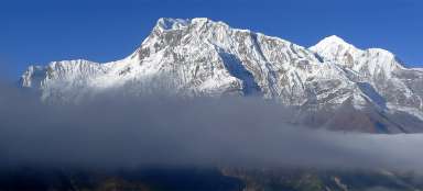
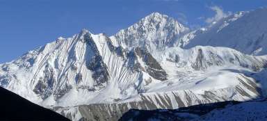
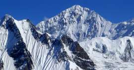
Annapurna II
The descent from the small cliff is really steep at the beginning. Then the way follows through the woodland, which is surprising in such arid landscape. Vegetation plays here with all colors and views of Annapurna II. give here the right himalayan mood.

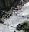
Tibetans
A tibetan family has a small buffet just before the confluence of the rivers, so you can have a tea here – perhaps even only out of solidarity. From the bridge you have to ascend only about 150 vertical meters and there is a major route Manang – Yak Kharka (from the crossroad it is still 40 minutes to the Yak Kharka).

Articles nearby


Article: Trek to Tilicho lake
Among the most beautiful trips in Manang belong a two-day trip to the high mountain lake Tilicho, so you will be surprised that… continue reading
Giga List: The most beautiful side hikes around Annapurna
The circuit around Annapurna is one of the most famous Himalayan treks. In addition to the classic itinerary, you can make a… continue reading
Giga List: The most beautiful stages of the Annapuren trek
The trek around Annapuren is considered one of the most beautiful in Nepal, or in the whole of Asia. It is also due to the fact… continue reading