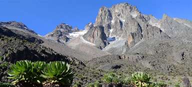
Hike Mt.Kenya Bandas - Mintos Hut
Under the top of icy mountain on the equ


The second day in the massif of Mt. Kenya is finally trekking. The ascent along the Chogoria route leads you at the beginning in grassy savannah, then above monumental Gorges Valley to the high mountain landscape surrounding Mintos Hut (4 290 m asl) – a small bivouac hut. You have to be here even in the main season prepared for frequent changes in weather, in the afternoon often for the worse, and to high altitudes without possibility to acclimatize properly.
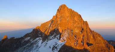
Massive of Mt.Kenya at dawn
There is frost in the morning, cloudless sky and the whole massif is in the distance nicely lit to red color.

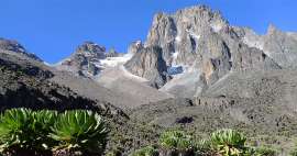
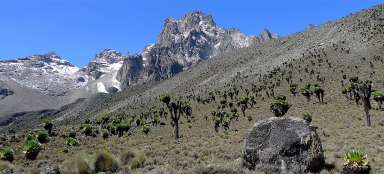
The path under the peaks of Mt. Kenya
Today's stage is quite challenging – in full gear manage 14 kilometers and 1,300 meters of altitude and ascend from mountain savannah up to the rocky peaks.

High mountain savanna
At the beginning the way leads along comfortable path in high mountain savannah lined by last remnants of the forest that ends at about three thousand meters above sea level.

Path in heathers
With increasing height changes the surrounding vegetation – savanna disappears and begin local heathers. The landscape is virtually impassable outside the path. The peaks of Mt.Kenya seem to be still very far away.

Above the river
After about three hours walking you come to a small stream (3 310 m asl), which is ideal for a refreshment. In its surroundings grow beautiful local lobelia. It is the first place on this walk where you will see them. Now begins the real ascent to the ridge above Gorges Valley.

Abandoned eastern part of the park
After half an hour of steep ascent disappears the valley of the river deep down. If you look back, you can see a large part of the massif in the east, where only a few people set off for a trip.

Gorges Valley
You will finally come to the outlook of Gorges Valley – here begins the most beautiful part of the walk for today, however, if you have nice weather. It can also snow here and you will not see much then.

The cliffs above Gorges Valley
The path rises high above the valley, above which tower beautiful rock formations.

Mintos Hut
In the afternoon can Mt. Kenya show why it is called ice mountain on the equator – cold, frost, snow or freezing rain is the daily routine here. Do not expect relax in Mintos Hut. It is just a simple bivouac hut, where even the door cannot be closed properly. In addition, you ascended to a height of 4,300 meters above sea level within two days, so you may start to suffer from altitude sickness.

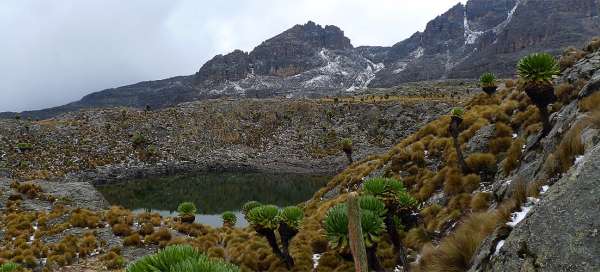
Lakes at Mintos Hut
Mintos Hut is picturesquely situated just a short walk from several lakes

Hall Tarn
The biggest of the lakes is called Hall Tarn. If weather permits, you can spend here hours by relaxing and walking around ponds.

Articles nearby


Article: Crossing of Mount Kenya
The crossing of the highest mountain in the country – Mount Kenya is certainly the most interesting and famous trek in Kenya.… continue reading