Hike Černý Důl - Chalupa Na Rozcestí
The most beautiful views of the Giant Mountains


The Černý Důl ski resort is a less frequently used tourist entrance to the Giant Mountains. He most often sets out for it to the mighty Montenegro. However, we will set off after beautiful views of the Krkonoše foothills through Tetřeví bouda to Chalupa Na Rozcestí.
Black Mine
This tour starts in Černý Důl (595 m above sea level), where you can easily get, for example, from nearby Vrchlabí. If you are here by car, you can leave it directly on the small square, where is probably the most important building of this whole town – Hotel Post.

Ski resort Černý Důl
From the square, head west along the yellow tourist sign. After a few steps you will reach the ski resort, where there is also a large parking lot. The slopes are here on the slopes of the Špičák hill (1,001 m above sea level), which you will basically have to climb.

Huge limestone mine
Before you start climbing, go to the viewpoint of the huge limestone quarry here. The fracture of the machines will accompany you for a long time to come.

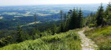
Beginning of the ascent to Špičák
At the end of March, there are only remnants of snow at this height. However, you will still enjoy it quite a bit above. The path leads along the meadow.

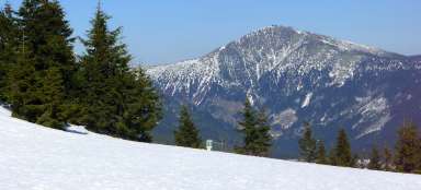
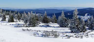
Panorama of the Giant Mountains
With increasing altitude meters, a beautiful view of the Giant Mountains opens up. The hiking trail shortens the curves of the narrow road used to supply mountain huts and the ski resort.

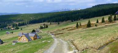
Bonisch's huts
After a 45-minute walk from Černý Důl, you are at the top of the ski slope. Bonisch's huts are picturesquely located around you. An ideal place for a break and enjoying the views of the Giant Mountains. There is no place to hurry, the next section through the forest is not so interesting.

The road through Jelení vrch to Tetřeví bouda
Now you can walk almost three kilometers through the forest, which is not very interesting. Basically, you will cross one hill – the indistinct Jelení vrch (1,024 m above sea level). There is also a crossroads of hiking trails in a place called the shipyard. You could also sleep in an emergency in the shelter.

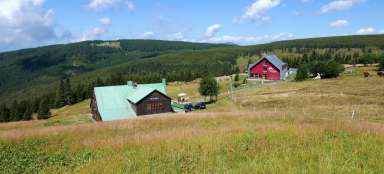
Grouse huts
After an hour and a half of marching, you are at the first large mountain hut – Tetřeví boudy. Here it is possible to have a snack or sleep. An ideal base for cross-country skiers during the winter!

View from Tetřevích bud
From Tetřeví bud there is a nice view mainly of Přední and Zadní Žalý on the horizon.

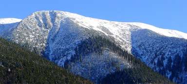
Cross-country ski trail and Montenegro
From Tetřevy bud we will continue along the green road. In summer it serves as a bike path and in winter as a great cross-country ski run. The road basically traverses the slope of Liščí hora. Looking back, we can enjoy the mighty Montenegro.

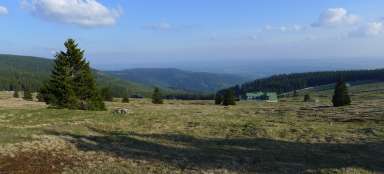
Observation balcony to the Giant Mountains
From this road there are really beautiful views of both the Krkonoše Mountains and the lower Krkonoše peaks.

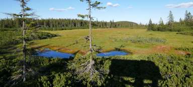
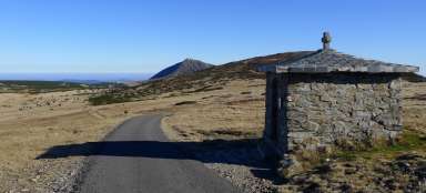
View of Rennerovky
You are slowly seeing the goal of this stage – beautiful mountain meadows below Světlý vrch (1,314 m above sea level) with a number of cottages.

At the Kotelský stream
Just before the end of this stage, you have two options, either continue straight on to the Dvorská bouda along the green, or continue along the main road and bypass the meadows on the west side. If you go a longer way you will see a small „waterfall“ on the emerging Kotelní stream.

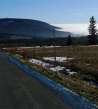
Wide view of the region
Just before you leave the highway to disappear into the forest following the yellow sign, you will have a really wide view of the path you took a while ago. Of course, Montenegro dominates the horizon.

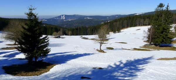
Rennerovky
At the end of March, there is still a lot of snow, so the ascent along the yellow hiking trail, where there is no snow, is quite challenging. Definitely the hardest part of this stage. After mastering it, you will finally have a wonderful view of the mountain meadow. From here, only a comfortable final ascent to Chalupa Na Rozcestí awaits you.

Articles nearby


Giga List: The most beautiful tours of the Giant Mountains
The Krkonoše Mountains are the highest Czech mountains and not only because of that, they offer great conditions for hiking. In… continue reading