Drive from Lake Kaweah below Sequoie
After Generals Highway


The drive along the Generals Highway to Sequoia National Park provides an experience at the end of April not only in the form of a tour of these huge trees, but also incredible changes in the landscape and weather in a short time. The route begins in the hot California valley just a hundred meters above sea level. Oranges and other citrus will ripen around you. In a moment, however, you will head to the Sierra Nevada, to altitudes greater than 2,000 meters above sea level, and suddenly there will be huge piles of snow around you.
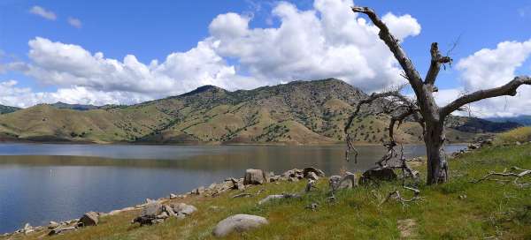
At Lake Kaweah
The famous Generals Highway (No. 198) connecting the California Valley with Sequoia and Kings Canyon National Parks begins near the small agricultural town of Lemon Cove. After less than 3 km drive you will reach the Kaweah Dam. Right at the beginning is a relatively large port (boat ramp1) for pleasure boats. If you want to make your ride to the Sequoi National Park more pleasant and walk along the shores of this lake, it is better to drive another two km to another large car park (boat ramp2).

Walk along Lake Kaweah
There is a footpath along the shore of this picturesque lake, so you don't even have to go through the wilderness. The hills rising on the other side of the lake exceed the water level by more than 500 meters and would certainly be worth the climb – the view of the lake and the Sierra Nevada on the horizon must be worth it.

Views of the foothills of the Sierra Nevada
After returning to the car from the walk, stop at least for a while in the eastern part of the lake, where there is a beautiful view of the foothills and in good weather to the three thousand peaks of the Sierra Nevada

Riding through the foothills of the Sierra Nevada
Another twenty kilometers or so is still driven through the Kaweah River valley, and the altitude increases only slightly. The surrounding slopes are colored purple.

Slopes of the Sierra Nevada
The road finally leaves the valley and enters steeply through a series of bends. Views of the surrounding impenetrable mountain slopes open up.

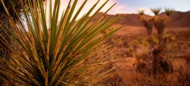
Vegetation of the Sierra Nevada
At the beginning of spring, the Sierra Nevada is a beautiful flowering mountain range, especially the purple colors you can enjoy in full sips

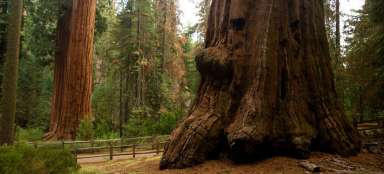
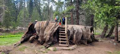
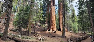
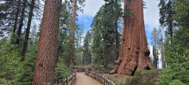
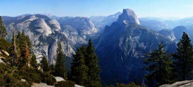
Giant Forest
After about an hour and a half and less than 60 kilometers (37 miles), at the end of this stage – in the parking lot at the Giant Forest at almost 2,000 meters above sea level – you are the perfect living space for giant sequoias (Sequoiadendron giganteum) – the largest trees on the planet, surviving three thousand years. This place is also the beginning of the „High Sierra Trail“ trek – but that's a different story.