Ascent to Zbojnícka chata
Hike through the Great Cold Valley


Zbojnícka chata is located at the end of the Great Cold Valley at an altitude of 1960 m above sea level. The ascent begins in Starý Smokovec. The stadium is followed by a 2-hour drive to the cottage following the blue sign, where it is necessary to overcome the highest climb.
Initial climb
The road from the beginning leads next to the cable car route in case of laziness, the first hour can be overcome in a few minutes with the help of the cable car.

Combs
View from Hrebienok towards the Great and Small Cold Valley.

Long waterfall
View from the sidewalk of the Long Waterfall

Studenovodské waterfalls
The Studenovodské waterfalls appear along the blue mark above Dlhý waterfall.

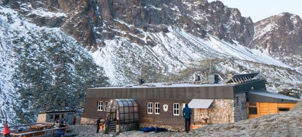
Rainer's shelter
Rainer's shelter, where you can buy hot and cold drinks and other little things.

Fox
One of the permanent residents of Rainerová and Zámkovský cottages, who is taught to live mainly from what he gets from people.

Tatra calamity
Also at the entrance to the Great Cold Valley you can see traces of the Tatra calamity from 2004.

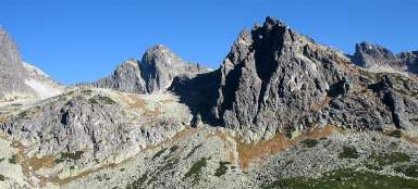
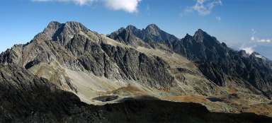
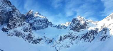
Surrounding massifs
One of the surrounding ridges lining the Great Cold Valley.

Kosodrevina
Gradually, the sidewalk leaves the coniferous forests and passes into the rhododendron zone.

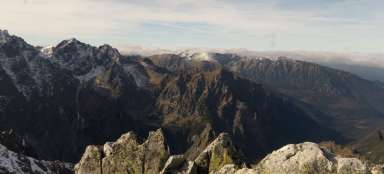
View of the valley
View down the valley.

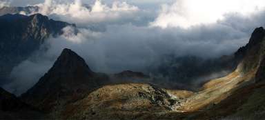
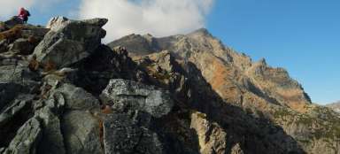
Foggy peaks
The surrounding peaks are in the clouds most of the day.

Climb
After about two and a half hours, the last steepest ascent to the cottage begins about 30 minutes.

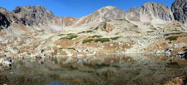
Long lake
A few meters below the cottage is Dlhé pleso.

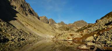
Sunrise
View of the sunrise from the cottage.

Morning
Morning view of the surrounding peaks enclosing the Great Cold Valley.

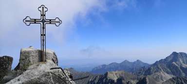
Bonus
Morning view of the end of the valley at the descent from Zbojnícka chata.

Morning view of the peaks
Morning view of the surrounding peaks separating the Great and Little Cold Valley.