Ascent to Mt. Antelao
Via Normale or Italian Normal


Mt. Antelao 3264m forms a significant peak in the form of a pyramid in the Italian Dolomites. I rank the ascent as one of the most difficult, as the elevation gain in one day can be over 2100m to about 8km. The starting point is from the village of San Vito di Cadore, from the parking lot at the ski resort in the direction of the Scooter riffugio. Due to the difficulty, this peak is little visited by tourists and one can experience true peace here.
Route description
My friends and I leave around 7:00 from the parking lot from the ski resort at an altitude of about 1100m. Right before the last building we have to turn left, where the road leads us across the bridge and further uphill to the cottage rifugio Scotter-Palatini 1570m. They open after eight in the morning and coffee comes in handy. After a short break, continue to the right of the cottage on the steps of a paved path to a crossroads pointing in the direction of Forcella Piccola. We just walk a little through small spruces, where the sidewalk leads steeply uphill and turns into serpentines in the rubble. This continues to the saddle at 2100m. In the saddle there is a cut tunnel ending in a window into the landscape. It can serve as a bivouac. From the saddle you can walk a few hundred meters to the rifugio Pietro Galassi. We continue up over the rocks and collect more meters up. The terrain turns into a rubble, where it is necessary to have a certain step. This is how we come to the rock, where the ascent to climb stage II. It is necessary to remember, keep to the right, the brand can be easily lost here. However, the rock is dry and with a certain step and the possibility to grasp the rocks well with your hands, it goes well. Perhaps only people who are afraid of heights could have a problem here, the sidewalk is just for the feet and down it falls almost vertically. Climbing takes us to a ridge where the fun doesn't end. We are also rewarded with views of the top and the surrounding hills. It's going well for a while, then places come like a rock plate that needs to be traversed, after another moment there are two sections with at least two climbs. We get to a rock blot with rubble and large stones. The elevation is beginning to be known, my friend and I end up in a place where there is a large boulder and a small plot for rest at about 3000m. Next is about 50 ° slope with rubble. The rest of the party continues and goes to try the summit. The progress slowed down and the boys then disappeared behind a rock. According to their information, the fun didn't end there either. They overcame several places with II climbing, one ledge, where there was a slope of several hundred meters and a section secured by a rope. Where at the end a small ridge and a top cross were waiting for them. The way down was not easy for the boys either, especially the descent down the blot with rubble, when there is nothing to hold on to. According to them, the place where we were waiting for the boys was better, but we still had to be very careful. We exhaled in the saddle, where we knew that the road is still relatively firm, we know the cant and we are really looking forward to being down by the car. We got it in the dark, thanks to a small stop at Scotter's Cottage.
Scotter-Palattini refuge
the mountain hut is the last point of reference where water can be taken. Antelao rises above the flags

Flora
flora over Scotter rifugio

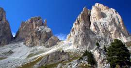
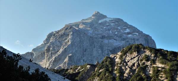
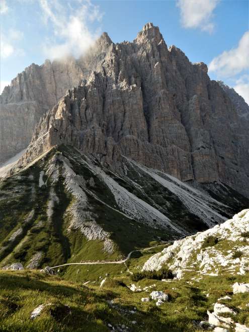
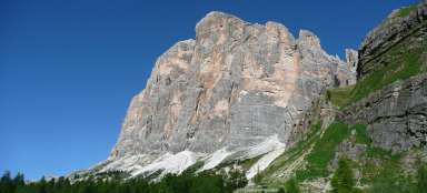
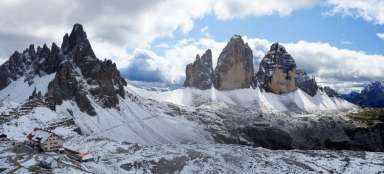
Antelao
view of the mountain from the rubble above Scotter Cottage

On the way up from the saddle
the road leads on the left side under the rocks to the rubble in the middle, where there is an entrance to the rock

Ibex
an ibex basked under the trail

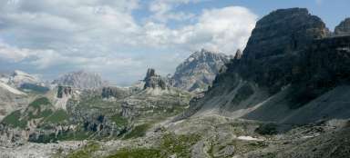
View to the Picolla saddle
the place where the rubble begins

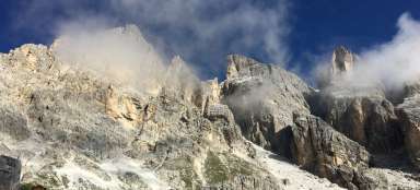
Camp
here the rubble turns into a rock

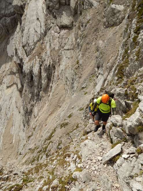
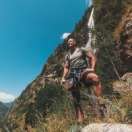
On the way to the ridge
sidewalk and a sure step to it
Ridge
we gradually pass to the ridge

Ridge
along the ridge between rubble and boulders

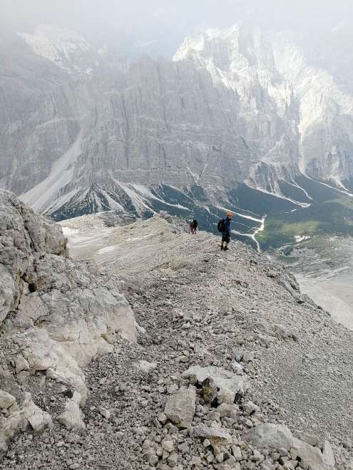
On a blot
the boys are slowly advancing below the summit

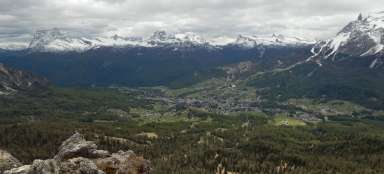
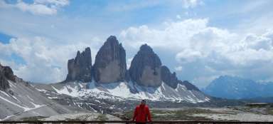
Outlooks
view of Cortina valley, from left Toffan di Rozes, Toffan di Mezzo

Under the top
a place where a friend and I decided it would be better not to continue

Outlooks
views of the valley and the surrounding hills around Cortina

Blotna below the top
on the way to the blot, it's a walker :-)
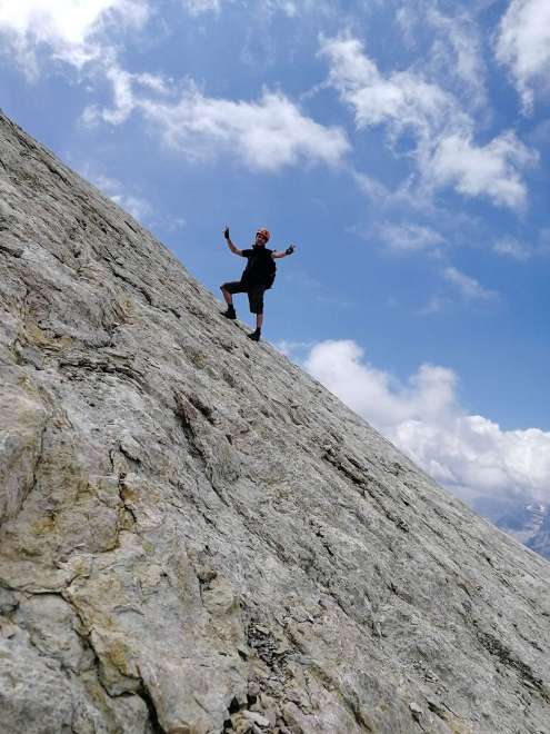
Top
just below the top

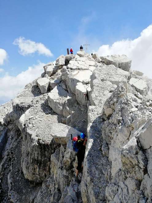
Top
the boys did it
Descent
upper part of the blot
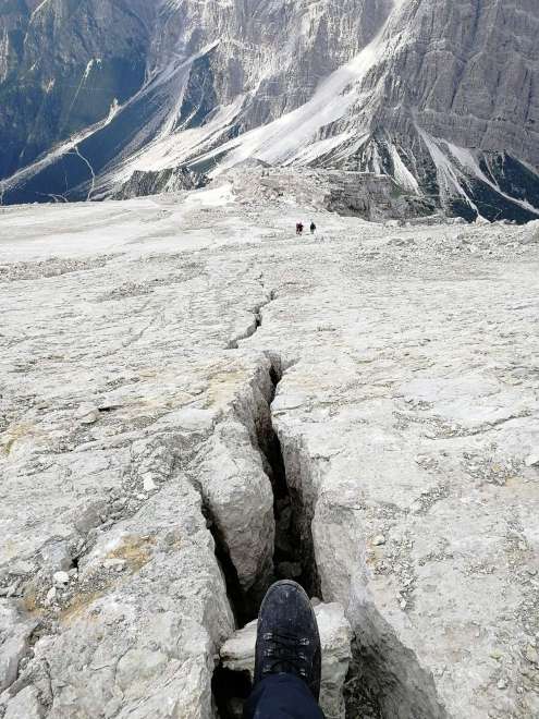
Crack in the blot
hooray down
Descent
just down

Forcella Piccola
look when we already said that the worst is over
Articles nearby


Giga List: The most beautiful hikes in the Dolomites
The Dolomites are considered one of the most beautiful mountains in the world. Massive rock massifs with fairytale rock towers… continue reading