Ascent to Mount Quzudosu (2224 m above sea level)
Ascent in the southern part of the main Caucasian ridge.


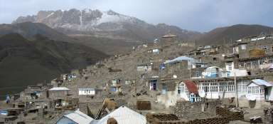
Mount Quzudosu is one of the many 2,000-meter peaks around the mountain village of Lahic, located in the Ismayili district of central Azerbaijan. From the village it is possible to make ascents to the surrounding peaks with views of the main Caucasus ridge. The village is also a local tourist destination with a traditional production of copper products, which you can be present in the small workshops of local metalworkers.
Ascent to the mountains Süke (2089 m asl) and Quzudos (2224 m asl)
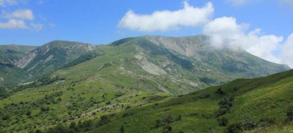
Azerbaijani Caucasus
Ascent to Süke and Quzudos
Lahic - Süke - Quzudosu - Lahic
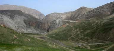
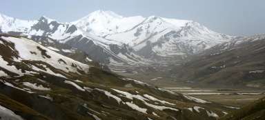
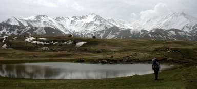
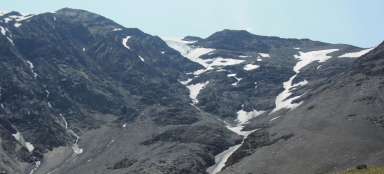
The ascent to the peaks of Süke and Quzudos is not difficult for the average trained tourist. The road rises sharply to the saddle below the top of Süke, but the terrain is passable without any problems. The problem is (and this applies to the whole of Azerbaijan) that no routes are marked and therefore this exit is not marked either. Orientation just by sight, maps are not. The beginning in the village of Lahic is at its northern end, where you can walk from the place where you normally park and where minibuses run (southern, lower end of the village) in 30 minutes along the local streets constantly uphill. The turn at the end of Lahič can be shown by the local guide Dadaš, whose homestay is not far from the turn. After the village, the route leads along a dirt road, but after a while it disappears and the choice of the next road is up to you. Do not climb directly to the top (if you do not see it – clouds – so it is not worth walking, if you do not know the route) but stick to the river, walk through an unmaintained apple orchard, which alternates with meadows and wetlands, sometimes there are noticeable sheep trails. By the river opposite the village of Ehen (it lies on the right bank, you go on the left) there is an imperceptible ford (there is still plenty of water in the river in the spring) from which the trail rises towards the pass below the top of Süke (2089 m above sea level). It is used by herders and their horses to travel to summer pastures. Try to hit it and go steeply uphill along it, the route is hidden in the growth of low trees. Pass the summer pasture (watch out for dogs, if there are sheep, they can be dangerous, if there is no shepherd in sheep and dogs, avoid dogs from afar) and follow it sharply to the pass, from where it is only about 15 minutes to the top. The pastoral trail continues to the other side of the ridge to the south to the villages of Sulut or Mücü at the foot of the Caucasus. From the top, which is bare, there is a view in all directions, you can also see Mount Babadag, one of the highest in the area (3629 m). Way back along the same route or you can go east and possibly ascend to the mountains Xat and Quzudos with a height of over 2200 m. When climbing Quzudos, the road from Lahice follows the same route to the summer pastoral station, just below the saddle below Mount Süke . Like other roads in Azerbaijan, this ascent is not marked. Orientation just by sight, maps are not. Pass the summer pasture (watch out for the dogs) and turn left behind it and cross the lower peak of the Süke to the left of the pass. Again, try to catch the trails trampled by sheep up to the ridge, which initially descends from the side peak of Süke to the place from where you then go directly to the top of Quzudos. You follow either the paths from the sheep or the grassy slope to the top, where there is a fairly tall stone man. You can continue further along the ridge to the east. From the top, which is bare, there is a view in all directions, you can also see Mount Babadag, one of the highest in the area (3629 m) and the beautiful waterfall Hacibala. Way back along the same route or you can descend sharply towards the river Cefele along a wide path of horses and sheep, which descends to the river a few hundred meters above the place from where you would start climbing towards Süke if you returned along the same route. This trail ends in the riverbed, which you then have to go back in the direction of Lahice. From the ford opposite the village of Ehen, descend to the village of Lahic along the same path you took in the morning.
Climbing the pass below Süke.
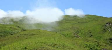
The road to the pass rises sharply from the summer camp of shepherds.

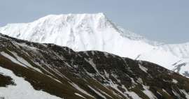
Quzudosu time.
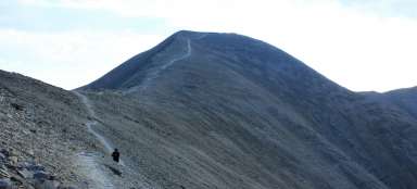
View from the slope below the peak of Süke over the pass and the eastern peak of Süke on Quzudos.

Descent to the river Cefele.
The horse and sheep trail descends from the pass to the river Cefele.

Quzudosu time
On the way along the ridge from Süke to Quzudos.
Quzudosu time.
A man on top of Quzudos.

Quzudosu time.
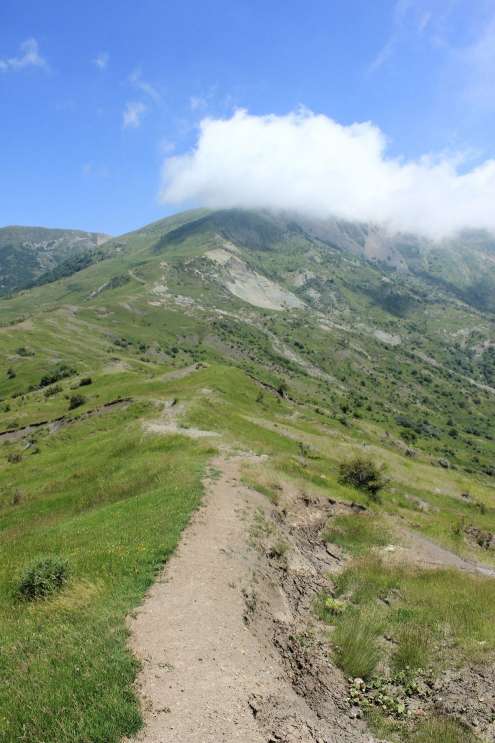
The final climb to the top of Quzudos.

Articles nearby


Giga List: The most beautiful tours in Azerbaijan
The eastern tip of the Caucasus, which is not so high in this part, extends into Azerbaijan. Even so, you will find several… continue reading