Walking distance to Butterfly Valley Beach
Butterfly Valley beach can be reached not only by boat, as you will read everywhere, but a


Before we visited this place at the beginning of June this year, I suspected that the well-known and one of the most beautiful beaches in Turkey can be reached not only by boat, but also by a more demanding footpath. However, I was unable to find more detailed information on how the route looks like. So there was nothing left to do but explore everything on our own about our vacation. And it really works! The path is indeed very demanding, so I recommend it only to those who are a little more skilled. Most importantly, you mustn't suffer from vertigo, which unfortunately one of our trip participants did :(. So we ended up doing 1/3 of it from top to bottom and coming back and then 1/3 from bottom to top the next day when we got to the beach by boat.
The beginning of the descent to Butterfly Valley beach
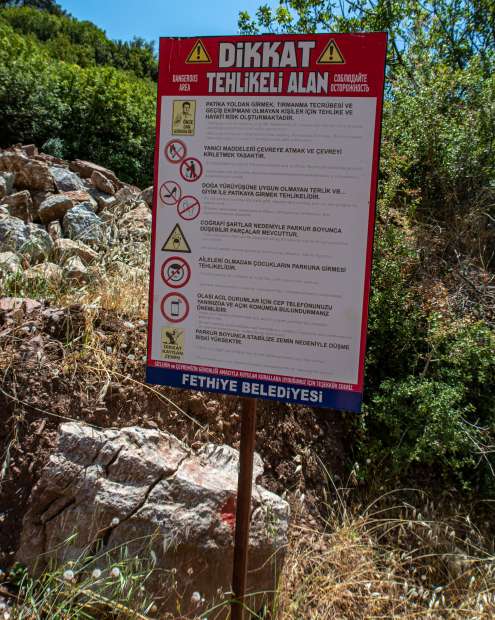
From the village of Hisar, we will take the Fethiye trail Faralya-Aktas-Kabak to the signpost with the warning sign in the photo.
The first view from the hiking trail to Butterfly Valley Beach
Along the way we will see some unconventional and often unpresented views of this beautiful butterfly beach.

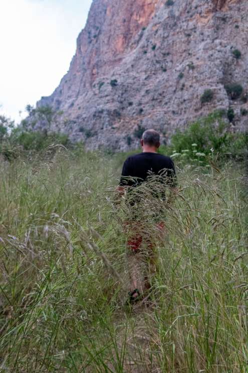
The journey from the beginning is not difficult
We will gradually reach the first smaller rock, which a wooden ladder will help us overcome.

The difficulty of the trail increases
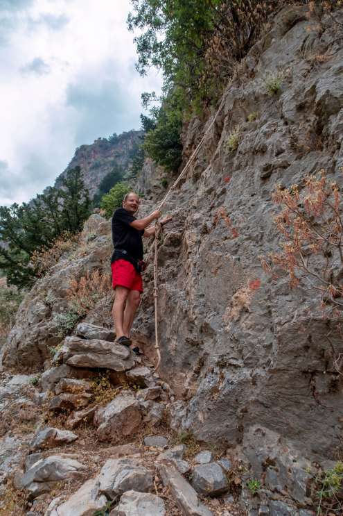
The next and the first of the three more demanding rock sections, always around 5 meters, will help us overcome the placed ropes, the rock has many unevennesses that can be comfortably climbed and used as stairs.

Honor marking
The path is well marked with red dots, on rocks, on stones on the path or by the path. Unfortunately, our journey from top to bottom ended here, due to the dizziness of one of the participants, the rest of us climbed back and returned to the starting village.

The road from the beach to the top
The next day, after getting to the beach by boat, we hiked from the bottom up. There are two marked hiking trails leading from the beach, the one with blue dots, the path from the beach on the left, which leads to the waterfall, which many tourists follow, and the one on the right, with red dots, which you need to look for a lot. Hardly anyone walks on it :D and it's so overgrown.

Up to the top
The road goes along a straight line, halfway up the valley, then it starts to rise slowly and so it slowly rises higher and higher.
Walking distance from Butterfly Valley Beach
The path is again beautifully marked with red dots on the rock or stones.

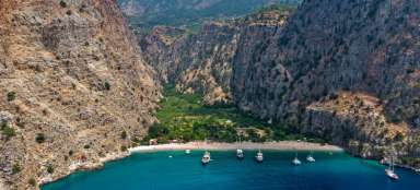
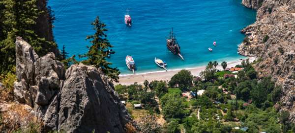
View of the butterfly beach
Behind us we again have beautiful views of this magical beach.

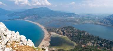
View of the valley
At times the path is quite narrow with a sharp drop into the valley. But the red dot is literally everywhere, so you absolutely cannot get lost.

First aid rope on the way
So far the journey has been easy. We reached the first of the three rock sections without any problems, which can be overcome using permanently attached ropes.
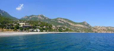
View of Butterfly Valley Beach
The way back down was more difficult, at least for me. The pebbles were rolling under our feet in places, and my husband and I, like always „dudes“, walked in sandals :D. Our legs got away a few times. I would recommend everyone who wants to try this route on foot to go from the bottom up. My husband and I definitely plan to do it sometime in the future. We just can't bring a friend with dizziness!

Walk to Butterfly Valley
Hopefully, this my, at least partial, mapping of the hiking route to Butterfly Valley will be useful for someone. Before our trip, I looked for any information for a long time whether it was possible to walk to this beach on my own and I found almost nothing :(. So maybe we will meet on this trip sometime in the future.