Article Midjor
Ascent to the highest mountain in Serbia - 2,169 meters above sea level

In the east of Serbia, on the very border with Bulgaria, there is the highest mountain in Serbia. The journey here to the start of the trek leads along various small roads through wild landscapes and crumbling villages and is thus an adventure in itself. Serbia is more of a lowland country, so even their highest mountain is set in pleasantly gently rolling mountains that are surrounded by green forests and meadows. The trek is easy to climb, the path is well marked and you won't meet many tourists here. On a route of about 7.4 km, you climb 618 meters to the top, and together with the descent along the same route, the trek should not take more than 6 hours.
Grandma's tooth
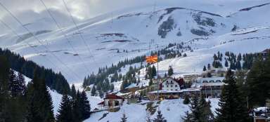
Since the beginning of the 1990s, the peak has been accessible to tourists from both the Serbian and Bulgarian sides. However, this was not the case before, because the peak is located in the border area. From the Serbian side, you can climb either from the village of Topli Dol or from the Babin Zub ski resort and continue along the ridge to the top. We also chose this second option. From the Babin Zub hotel, the path to the top is 7.4 km long. No permits or fees are required to climb.

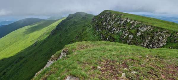
Views of the rock massif
From the Hotel Planinarski Dom Babin Zub, where we left the car parked, we climb with views of the rock massif at the top, after which the area is named. After a few meters of the journey, we pass by the bistro to the final station of the cable car. Beyond that, there is only untouched nature.

Blooming meadows
After the first steep climb, we reached a beautifully blooming meadow on the plateau, which already has a more pleasant slope. We traverse further up the footpath and admire the various flowers around us.

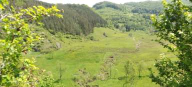
Deep woods
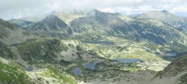
Serbian mountains are dense forests, pastures with horses or cattle, and the green color of rounded hills everywhere as far as the eye can see. You run into people here really sporadically.

Markings on the route
It is impossible to get lost on the route. On the one hand, the path leads along a wide beaten path, there are sometimes stones marked with signs and also several signposts with arrows.

Wild horses
On the ridge before the final climb to the top, we were lucky and came across wild or semi-wild horses grazing freely here.

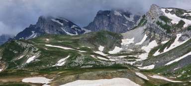
View on the Bulgarian side
We climb the final meters to the top literally along the border, when the path allows us to peek at our neighbors on the Bulgarian side. But we will only know about it thanks to text messages from the operator who welcomes us to Bulgaria. The landscape on this side of the border is very similar to that in Serbia, green forests and meadows everywhere.

Border post
The remnants of the border posts that have stood the test of time have had their say. But we're not just targeting a few survivors. The rising fog is slowly pouring in from the Bulgarian side, so we are not lazy and continue to the top to catch the views.

Peak Midžor 2,169 meters above sea level
You can meet two versions of the name of the mountain – Midžor or Midžur. At the top there is only a stone cross with remnants of the Serbian flag and some travel stickers. We managed to enjoy the views before the cloud started to roll in and the wind picked up, driving us back down.