Hike Ghandruk - Nayapul
Around the rice terraces

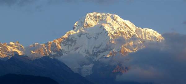
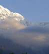
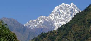
The long descent from the village of Ghandruk (2 050 m asl) to Nayapul (1 020 m asl) is the final stage of BC Annapurna trek, but quite often pass here also tourists from Poon Hill trek, which they prolonged for the visit of village Tadapani. The path leads between rice fields high above the valley of river Modi khola. Be sure to get up early in Ghandruk, so that you can admire the sunrise on Annapurna South (7 219 m asl).
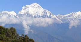
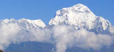
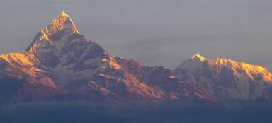
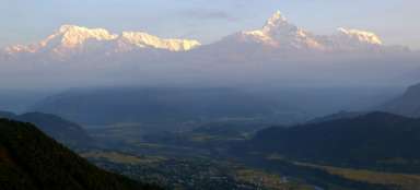
Sunrise on Annapurna South and Hiun Chuli
From Ghandruk is a nice view of the southern part of Annapurna Sanctuary with a significantly dominant Annapurna South (7 219 m asl) and the „pocket-sized“ Hiun Chuli (6 434 m asl).

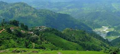
Ghandruk
Ghnadruk, moreover, like almost every village in this area, is built on a slope and each „floor“ of the village is linked by the long staircase. Interesting are the original folk houses.

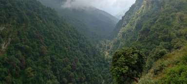
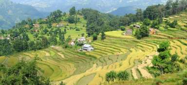
Endless rice terraces in Landruk
Landruk is not more than a kilometer from Ghandruk as the crow flies, but due to the deep valley of Modi khola the walk takes almost the whole day. The surrounding rice terraces are really impressive.

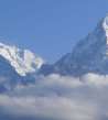
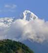
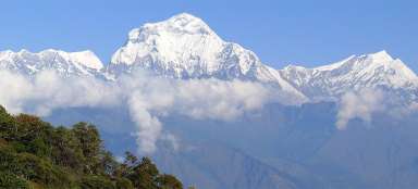
Hiun Chuli
Also during the descent from Ghandruk are on the horizon visible glaciated Hiun Chuli. You just have to always count with the fact that the southern windward side of the massif is significantly more under the clouds than the northern side in Manang, where you can see the mountains almost every day in main season.

The outlook of Kimche
Already after a few minutes of descent from Ghandruk you will see a long part of the way that is still waiting for you. First overcome the canyon of the river Chane khola and then large rice area near villages Chane and Kimche.

Houses in Kimche
After about half an hour walk away is the large agricultural area near villages Chane and Kimche. You will see here lots of interesting houses, some virtually sunken into rice terraces from all sides.

Path through the rice fields
The path itself leads along the paved sidewalk – traversing for a while, descends for another while.

Views
This descent stage is not very mountainous (considering the Nepalese conditions), but you will enjoy here a lot of nice views.

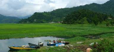
View of the valley of Modi khola
You will gradually descend almost to the bottom of valley of Modi khola. The last part of the trek through the canyon from Syauli Bazar to Birethanti and on to Nayapul is already quite boring without any interesting views.

Articles nearby


Article: Poon Hill trek
The ascent to the beautiful outlook place Poon Hill is very popular among visitors to Nepal because it is easily accessible from… continue reading