Article Goosenecks State park
The stunning meanders of the San Juan River


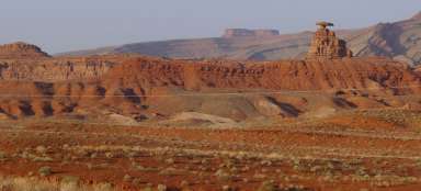
About 100 miles south of Moab in southwestern Utah, just 4 miles off US 163 is a small state park dominated by Goosenecks Viewpoint. This year-round accessible park is relatively little known and visited. Still, it's a great place for a picnic, camping, or hiking. There are several hiking trails that run along the San Juan River with stunning views of the deeply incised meanders.
Goosenecks Viewpoint
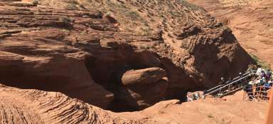
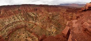
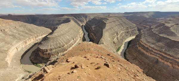
The best view of the meandering river is from Goosenecks Viewpoint. The viewpoint is very easily accessible and offers a truly breathtaking view of the canyon. Visitors can enjoy this natural wonder from here. The San Juan River here has formed a series of U-shaped meanders that look like goose necks along a stretch of about 27 km. It is the result of several hundred million years of erosion and is one of the most striking geological features in Utah.

Meanders at a depth of 300 meters
Spectacular views of more than 300 meters below the lookout are said by many to surpass the much more popular Horseshoe Bend, which lies about 140 to the southwest. Thanks to the remoteness of the park, there are exceptionally good conditions for night stargazing.

Camping
In the park, there is an option to spend the night at the simple Goosenecks State Park Campground. It offers only a few picnic tables and a simple toilet, and there is no source of drinking water. It is also necessary to keep in mind that there is desert weather here.