Below the Baatar Khairkhan glacier
Ascent to elevation 3692 below a small mountain glacier

A one-day ascent below the small peak mountain glacier Baatar Khairkhan (also Baatar Hayrhan / Баатар хайрхан уул) a less steep northwest road. In the summit of the Baatar-Khairkhana ridge, there are many interesting morphological phenomena associated with extreme climate and glacier activity. The elevation of 3692 m itself has no name, although the side hump with a height of 3646 m has a name (Бурхад уул).
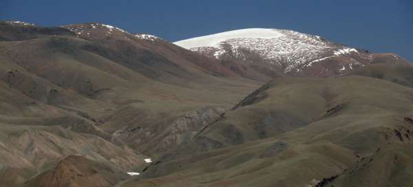
View of the Baatar-Khairkhany ridge from the west
At the beginning of June, there is still snow in the higher parts. The glacier is a white peak on the far right. The rugged terrain allows you to climb from this side in one day, if you start from the end of the valley Gants Modny gol.

It is no longer possible to drive
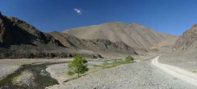
The farthest can be reached by car to the confluence of the tributaries of the river Gants Modny. The whole valley is passable upstream by off-road car all the way here, you have to continue on foot.

Climbing the valley
About half of the way leads along the bottom of the valley in an east-south-east direction, so the road goes quite fast. It is necessary to climb a little over 500 altitude meters (approximately from 2450 to 3000 m above sea level).

Frozen valley
There is still plenty of snow and ice in the narrow valleys at the beginning of June. In some places, the melting water gnaws at narrow deep gaps.

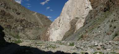
Ravine
Later, the valley slowly closes and turns into a relatively narrow gorge. You still need to go through this (and if spring or summer is advanced, also watch out for snakes) and only then start to climb. Climbing over the gorge right at the beginning and trying to climb the ridge from there would certainly be possible as well, but it would be more difficult and probably steeper.

The upper end of the gorge
After passing through the gorge, the valley opens slightly again and here it is possible to start climbing the ridge.

Perpendicular to the contour lines
Then it has to be perpendicular to the contour lines, it is necessary to overcome another 500 meters of altitude.

Flora
Thus, in the spring, the slopes are still covered with quite rich (locally) alpine flora.

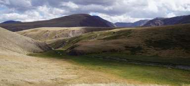
Panorama of Altai
After a challenging climb, beautiful views are already opening up. The valley in the middle of the photo is what we climbed up.

Up after the rubble
The ascent in the higher part of the slope is a bit more difficult, because it is basically in the rubble. It is a bit stabilized by clay and finer stones, but you still can't look under your feet. Temperature changes during the year easily fluctuate between values from +30 to –50 ° C, so the slopes are constantly sliding down slowly. There are no roads or footpaths here, so the movement of places resembles climbing an active volcano.

Granite rock town
The top parts of the ridge are formed mainly by granite, or granite. It usually breaks down into rocky seas, but in this case there is a small rock town, providing a small lee. Alternatively, you could also camp here, if the hike should last longer.

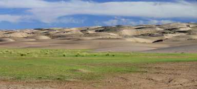
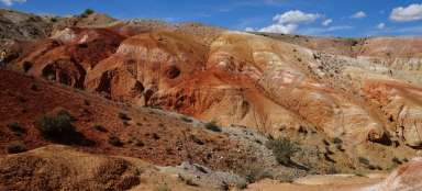
Wasteland
The view to the south looks more like from another world, like somewhere in the middle of Iceland. The landscape is more semi-desert than steppe.

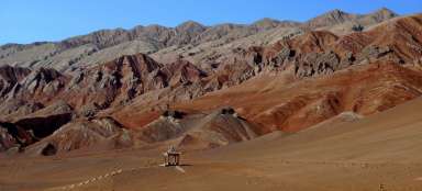
Final view of the glacier
From elevation 3692 it doesn't seem too far to the glacier, but let's not underestimate the clean mountain air – it is still almost 7 km as the crow flies to the edge of the ice field. Unfortunately, due to time constraints, we did not manage to get to the glacier, but if the trip is planned for two days, it is quite real. However, the ridge is quite exposed and without lee, so it is better to look for a place on the tent carefully.

...and finally
We chose the return route similarly to the ascent route, with slight turns and descents. It gave almost 30 km to the starting point of this one-day hike with a total elevation gain of about 1200 m up and down. There is a theoretical possibility of climbing to the glacier from the north, from the Zereg somon, but on the one hand the slopes are much steeper from this side and on the other hand the permeability through the valleys is even worse.