Ascent to Atalaya de Femés
Ascent to the highest mountain in the south of Lanzarote


Easy ascent to the scenic peak, from which there is a wonderful view not only of the south of Lanzarote and neighboring Fuerteventura, but also of the volcanic landscape of the Timanfaya National Park.
The village of Femés
Although there is a relatively dense network of bus lines in all the Canary Islands, car rental is the best option for transport. The starting point is the small village of Femés in southern Lanzarote.

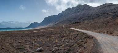
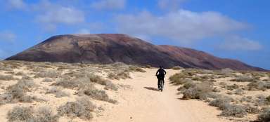
Ascent to the top
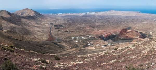
The exit path is not marked in any way, but easily identifiable. All-terrain vehicles drive on it, because there is a system of transmitters at the top. With increasing altitude meters, the view of Fémes and a pair of peaks beyond the village gradually opens up: Pico de la Aceituna and Pico Redondo. Unmarked paths lead to these as well.

January
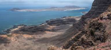
At about 550 m above sea level, we turn right and take a walk to a place that offers a nice view of the west coast. The Janubio salt fields near the village of La Hoya are in the palm of our hand.

On the top
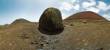
We are at the top at a height of 608 m. There is a system of masts with antenna systems and the wind is pretty nice.

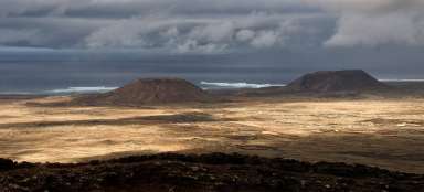
Top views
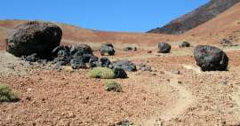
We bypass the top and the technical background of the transmitters in order to have the best possible view of the surrounding landscape. The volcanic cones of Timanfaya National Park are especially interesting.

Laguna Verde
The way back to the parking lot is fast, so we decide to go to another interesting place on the coast. We drive towards the village of El Golfo. On its southern edge is a natural attraction. In an old volcanic crater, which plunged into the ocean, a lagoon was formed, whose characteristic green color is caused by algae at the bottom of the lagoon. We drive through the village of El golfo to its northern edge. From here, a narrow path leads along the ocean shore, which is surrounded by fantastic lava formations created by eruptions between 1730 and 1736.

El Golfo
Finally, we return to the village, a former fishing village, which today offers mainly relaxation, accommodation and great culinary specialties.

El Golfo
As usual, we move outside the main tourist routes and find various characteristic corners that also belong to El Golfo.

Articles nearby


Giga List: The most beautiful hikes in the Canary Islands
The Canary Islands offer a variety of beautiful tours not only in the volcanic landscape, but also in the misty forests or along… continue reading