Ascent to Calderón Hondo
Road to the sightseeing crater


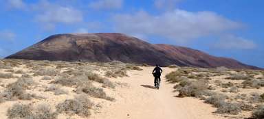
The northern part of the island of Fuerteventura offers the possibility of several hiking tours through the volcanic landscape with relatively well-preserved craters. Although they do not reach any monumental dimensions or height, they still bring a nice view of the surrounding landscape after climbing to their edge. In this respect, the peak of the Calderón Hondo volcano (278 m above sea level), which is easily accessible from the northern tourist resort of Corralejo, is a grateful destination. If the weather is pleasant and there is no rain show, the southern hills of the neighboring northern island of Lanzarote can be seen from the top.
Corralejo
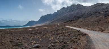
The journey begins in the tourist center of Corralejo. It is a tourist route GR131, which leads to the south across the island.

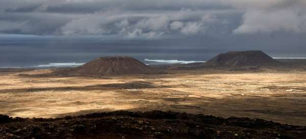
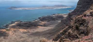
Lanzarote
Corralejo is also the port, from which you can easily get by a ferry to the neighboring island Lanzarote. Its southern coast is a very well visible from the path.

Montaňa de la Mancha
Wide dusty road leads around the volcanic peaks (on the left in the direction of walking to southwest). In the north and northwest direction is uncovered view of small farms with another volcano Montaña de la Mancha in the background and island Lanzarote on the horizon.

Montaňa Lomo Blanco
There is another distinct peak in the barren volcanic landscape. The slightly undulating path passes various stone walls separating individual plots. In small farms are usually bred goats and sheep.

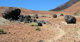
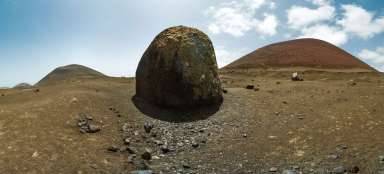
Calderon Hondo
From the main path leads to the crater on the right signposted narrow path. It ends at the northern edge of the crater at an altitude of 227 m asl. Another continuation to the top is on the right through the free terrain along the edge of the crater. From the height of 278 m asl is. a panoramic view around the whole northern part of island Fuerteventura.

Playful weather
It is worth not to rush and spend some time at the top. Rapidly changing weather can conjure up in the surrounding countryside an interesting play of lights and shadows with a backdrop of surrounding volcanic peaks and neighboring Lanzarote.

Barren landscape
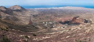
In the southeast direction is visible the chain of volcanic peaks dominated by Montana de Ecanfraga, which touches with its 533 meters asl the low trade wind clouds. There is no path leading to the vast majority of these peaks and so tourists need to consider their capabilities and capacities during the ascent in free terrain.

Lajares
There is village Lajares in the southwest of the neighborhood of Calderon Hondo. It is possible to walk down here and use a bus to the place of accommodation. In the case of using the car from the starting point there is no other choice than to accept the return by the same route. The wall of highest island peaks with an altitude of around 800 meters above sea invites for exploration in the southern horizon.

Articles nearby


Giga List: The most beautiful hikes in the Canary Islands
The Canary Islands offer a variety of beautiful tours not only in the volcanic landscape, but also in the misty forests or along… continue reading