Trip to Los Muchachos
Along the northern edge of Caldera de Ta


One of the biggest attractions of the island La Palma is the national park Caldera de Taburiente. It also includes the highest peak Roque de los Muchachos (2 426 m asl). Conversely, the lower part of the volcanic valley is only at a height of 400 m asl. There is a circuit path leading on the edge of this natural gem that offers breathtaking views of the surrounding countryside. The access is very easy, because the northern edge of the caldera is well passable by car along a good-quality mountain road. The way described below is a short, but beautiful walk from the parking place at Roque de los Muchachos in the eastward direction to just beyond the peak Pico de la Cruz.
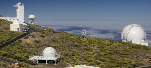
Astronomical observatory
The fact that a road leads to the top is probably due to the presence of a relatively large astronomical observatory. There's a series of domes and other equipment of various European scientific institutions. There is a small exhibition in the building of visitor center and you can book here a guided tour to see some astronomical instruments.

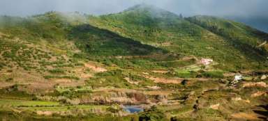
The view to the south of La Palma
We recommend to set out in the morning, because the upper parking place has limited capacity and there are not many free places during the day. But not many tourists undertake here longer walk to the east. A view of the island to the south opens after passing several astronomical buildings.

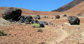
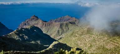
The bottom of caldera
Big difference in height between the edge and the bottom part of the caldera is very nice. If you want to, you can diversify the views (carefully) by climbing on the surrounding rocky volcanic formations.

Flowing clouds
Further in the southeast direction clearly emmerges very typical phenomenon in La Palma. In the center of the island stretches from north to south pass Cumbre Nueva and this separates the eastern and western part. Trade wind clouds roll very often there from east to west here, flow around the pass and then miraculously melt. A long road tunnel leads inside of the pass. You will drive inside it on the eastern side with wipers on, but the sky will be clear at the exit on the western side. A small miracle.

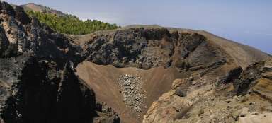
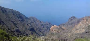
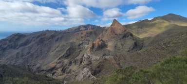
The southern edge of caldera
These three striking rock formations cannot be missed. They will nearly encourage you to stop and look down and around. The southern part of caldera is guarded by the tops Piedras del Catre (on the left) and Pico Bejenado (on the right). You can get to both of them along marked trails. To the south stretches the ridge, along which leads „volcanic path“, i.e. Ruta de los Volcanes – another „must“ of the island.

Rock walls
The result of two kilometers long height difference are very steep rocky slopes.

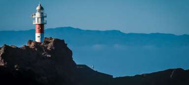
Outlook point
It is possible to walk to the official outlook point after returning to the car park. Most tourists usually head here.

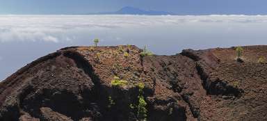
Tenerife
If it is already afternoon and the sun is somewhere in the southwest to west, you can often see to the east located neighboring island of Tenerife from the outlook point. Or more accurately, to its most monumental part – stratovolcano Pico de Teide, which proudly rises to a height 3 718 m asl.

Astronomical equipment
You can make another stop at any of the astronomical equipment when going down from the edge of caldera. Very interesting are for example two microwave telescopes.

Articles nearby


Giga List: The most beautiful hikes in the Canary Islands
The Canary Islands offer a variety of beautiful tours not only in the volcanic landscape, but also in the misty forests or along… continue reading