Hike across pass above Ishak Pasha
View of Arararat and Kurdish villages


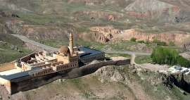
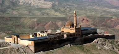
If you would like to undertake a hike in the neighborhood of the fabulous palace of Ishak Pasha Sarai, you can cross the old farm path to Kurdish villages to the other side of the mountain with beautiful views of the Great and Little Ararat. Remember, however, that after you end up hiking on the main road linking Dogubayazit with the Iranian border (20 km from the town, 15 km from the border), so you'll either have to hitchhike or expect four extra hours of walking on the way back.
Rocks above the palace Ishak Pasha
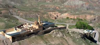
Set out from the palace straight up the wide path that is sometimes used by farmers as a way to the patches on the fertile plateau. Nice outlook rocks will tower above you from the weathered slopes.

Above the palace of Ishak Pasha
The palace will slowly disappear on the horizon after less than fifteen minutes’ walk up. There will be also more silence and the landscape around you will be with increasing altitude greener.

Steep slopes
There are two main view types on the way up along the field path – both on the mountain ridge full of sharp rocks and on fertile upland plateau with fields.

Outlook massif
The first phase of the ascent from the palace leads to the pass at a small massif. If you do not want to walk the whole trek, can walk only here, or scramble to the adjacent mountain to about 2,300 meters above sea level.

Volcano Tendurek dagi
Thirty kilometers south as the crow flies tower shield volcano Tendurek (3 584 m asl).

Colorful volcanic landscape
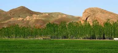
Along the way there are nice views of the local colorful volcanic landscape. At appropriate places there are small fields.

In the pass
You will reach the highest point on this hike after two hours of ascent from the palace – to a flat grassy pass (2 440 m asl), from where you have views of the mountains in Iran (distant from here only about ten kilometers). If you want to, you can ascent to the top of the mountain above the pass, which is another about 200 altitude meters.

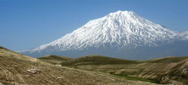
View of Ararats
Just a short walk under the pass our path links to a dusty farm road and after about half an hour walk will discover an amazing panorama of both Ararats. Ararat (5 137 m asl) with its glaciated tip belongs among the most beautiful volcanoes in the world. Farther lower is Little Ararat (3 925 m asl), without snow, but with steeper slopes.

Descent in tuff landscape
The volcanic origin is apparent on the surrounding countryside. There are exposed layers of tuff on the road and it is thus quite dusty. Signs of human habitation slowly become apparent here.

Kurdish village Dostali
After 8.5 kilometers walk from the palace (about 3 hours) you come to the first Kurdish village Dostali (2 030 m asl). If it were not for the satellites and wires with electricity, you would feel here like in the Middle Ages.

Residents of Dostali
Women and children are naturally curious about rare aliens walking in their villages.

Provision of drinking water
There is no water pipeline in the village, so water has to replenished with artificial barrels. This lady has an invention in the form of a walking tank for water :-)

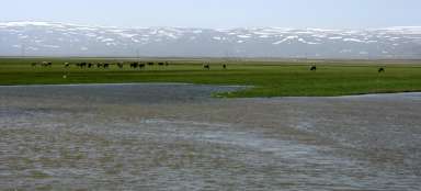
Another views of Ararat
Dusty road from Dostali traverses further the slope and disappears in the wrong direction. You set out along the footpaths straight down to the west. The destination is the bed of the river leading to the village Noreşin. Except for the volcanic rocks, there is another nice view of Ararat on the way.

Kurdish women
Below the mountains it is also necessary to carry water. But this one does not look as appetizing as water a few hundred meters above.

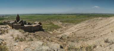
Noresin
After less than four kilometers of descent from Dostali you come to the next village of Noresin lying just off the main road connecting the Iranian border with Dogubayazit. Then you have no other choice but to hitchhike and hope that someone will give you a ride.
The only thing you will find frightening on this walk will be big shepherd dogs in villages along the way. And therefore having a stick in the hand is not off-topic here.

Articles nearby


Article: Ishak Pasha Trek
The best one day trip from Dogubayazit leads to a beautiful otomans palace of Ishak Pasha Sarayi and farther into the mountains… continue reading