Drive Tehran - Rineh
Driving under Damavand


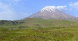
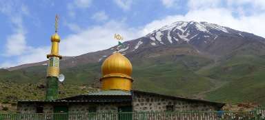
If you aim to ascend to the highest mountain in Iran – the majestic volcano Mount Damavand or undertake some other interesting hike in the eastern part of the mountain Elborz, the ideal starting point is the town Rineh (2 050 m asl) just about 100 kilometers from the country's capital Tehran. Along the way you will see the satellite settlement in the desert, green oasis between arid mountains, winter ski resort, Mount Damavand and from Polour also nice mountain views.
Landscape behind Tehran
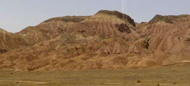
Broad highway 77 leads from Tehran for a long time eastwards through mostly very arid landscape. Only around rivers flowing down from the southern slopes of the mountains Elborz there are green oases. In this area the highway passes oasis Jajrud lying by the river flowing from the dam Latian.

Surroundings of Pardis
The new satellite construction in the dredged desert slopes is far from being picturesque.

The outlook of Abali
The road is still rising and after a while you get to a very nice outlook of the oasis Abali (2 075 m asl).

Mobarkabad
From the outlook point is very nice view of Mobarkabad (2 200 m asl), though which you have passed a few minutes ago. Interesting are the solitaire trees growing in an otherwise barren mountain slopes. The Mobarkabad you can easily ascend to several lower mountains in its surroundings.

Mosha valley
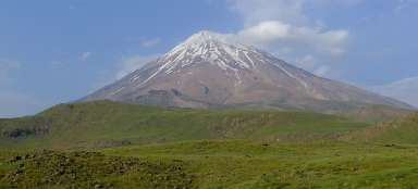
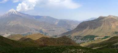
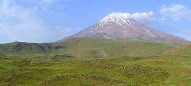
The road rises up to the parking place of Abali Ski resort (2 450 m asl). If you're here in the winter, you can ski. And if you have some time in the summer, you can ascend to the ridge (2 680 m asl), from where is in the good weather visible Damavand. Directly below you stretches wide, flat and green valley of Mosha. The road culminates in Emamzadeh Hashem pass (2 700 m asl). From there the water flows already into the Caspian.

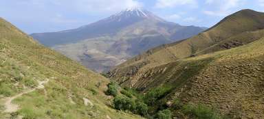
Wonderful view of the canyon
The path descends to Polour (2 240 m asl), where you have two options how to continue. If you are coming by bus, go down the main road through tunnels through the canyon of the river up to the crossroad under Rineh (1 660 m asl), from where you can get there either by stop or taxi. The second and much better option is the „upper“ road along the upland plain below Mount Dama, which also offers beautiful views of both the canyon and the surrounding mountains. Along the way you will also pass the turnoff to Lake Lar, which is a nice side trip or a starting point for several days lasting nice trek.

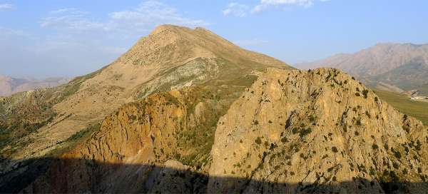
Ridge Doberar
From the outlook points on the upper road is nicely visible also more than 50 kilometers long and four thousand meters high ridge towering above the upland plains.

Elborz
For Elborz are typical both long ridges with a few insignificant peaks as well as perpendicular, indomitable limestone cliffs.

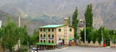
Arrival to Rineh
Finally, below you appear Rineh oasis (also called Reyneh). On the horizon towers mountain Ebrat, an interesting destination of possible acclimatization trip.

Articles nearby


Article: Ascent of Mount Damavand
The ascent of the highest Asia's volcano Damavand is the most famous and also the most frequently walked hike throughout Iran.… continue reading