Drive Skardu - Askole
Long way to start of the trek


One hundred and twenty kilometers along a dusty road from Skardu ( 2,235 m asl) to Askole (3045 m asl) takes by jeep around seven hours, so basically the whole day. Even so, it makes the beginning of the trek much easier. A few years ago you would have to start the trek much earlier. The road leads through a wide valley of the river Shigar full of oasis before it turns sharply off to the east and rises through the valley of the river Braldu fed from huge glaciers of Karakorums ridge.
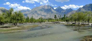
Shigar valley
From Skardu you need to continue at the beginning quite long against the flow of Indus through Hussain Abad to Thorgu, where is the only slightly narrow place, so there is a hundred-meter wide bridge across the river. You will then go through the desert landscape around the mountain with a huge sign welcoming you to Shigars valley and further across the pass (2440 m asl) to the lookout of this, in these places, four kilometers wide valley.

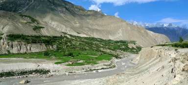
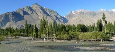
The mouth of the valley Shigar
On the horizon you can see the place where the river Shigar flows into Indus.

Driving through the valley of Shigar
An asphalt road leads from Skardu up to the district town of Shigar that can boast with a nice palace. Then the quality of the road significantly deteriorates and the ideal means of transport is a Jeep – the most popular in Pakistan are ancient Toyotas. Directly above the valley rise five thousand high mountains.
An alternative for those who want to get used to walking before the main trek is a walking shortcut from Shigar to Askole across the pass Skoro la (5070 m asl). This crossing takes at least three days.

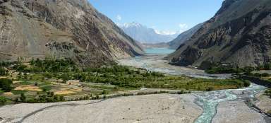
The tunnel at the intersection of valley
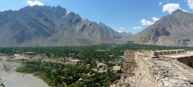
More than three kilometers wide valley ends at the confluence of two rivers – further upstream the two valleys (Shigar and Braldu) already look more like canyons. The local attraction is a short tunnel, around which there is also a nice lookout.

Confluence of valleys Braldu and Shigar
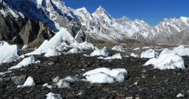
The confluence of the valleys look more like a vast desert – all these are sediments of rock milled by the glacier.

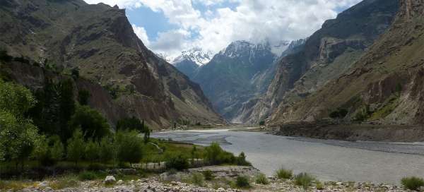
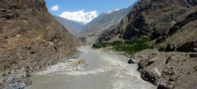
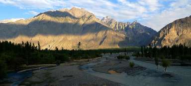
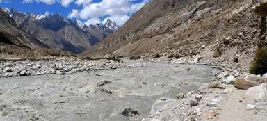
The picturesque valley of river Braldu
Long way to Askole is exhausting, but the views of the surrounding mountains are very nice.

Ford on the road
Some streams from side valleys flow directly across the road, which is another reason why mostly off-road vehicles run here.

Oasis in the mountain slopes
Clean water from not-glacier origin is very valuable here, so there are green oasis stretched high into the sides of the mountains around any the stream.

Field and orchard in one
Mostly grains and fruit trees are grown here.

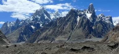
Wild valley
The valley gradually becomes more barren and wild. You are going in places where the guide will probably tell you that they used to go here on foot. You will be going in twists around landslide slopes high in the hill.

Incredible narrowing of the river
The guide might want to bet with you that he will cross the river Braldu in one step – which may seem impossible and incredible, because the river has a width even in the narrowest places around 50 meters. But once you come to this place, where a huge landslide nearly buried the river, it really disappears quickly and becomes just a meter wide crack. It's really incredible.

In front of Askole
After seven hours of driving you finally approach Askole. But the most difficult part of the journey is waiting for you (or rather for the driver) – exit along bad-quality path from the river to the village. The view of the opposite oasis is great.

"Bus station" in Askole
You will not definitely find classic bus station in Askole.

Camps in Askole
Trekkers and mountaineering expeditions build tents in the local camps– you can guess from the size who is going to K2 and who walks only to Concordia :-)

Articles nearby


Article: Gondogoro Trek
One of the most impressive mountain areas of the world lies on both sides of Baltoro glacier. Mountain range Karakoram is… continue reading