Along the ridge from Zehnerkopf
A more adventurous route under the Elferspitze

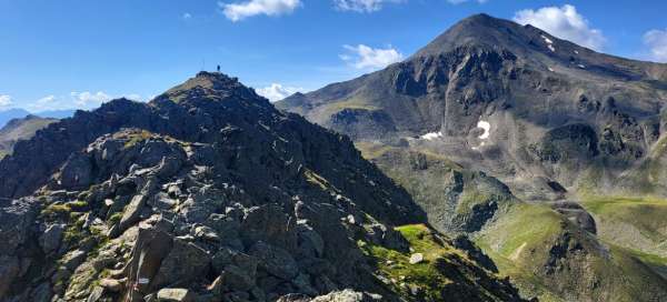
Zehnerkopf is a beautiful viewpoint of the Lago di Resia dam and the start of a circular trip. After enjoying the views from the top, you need to decide what to do next. If you don't want to climb down from the top and return to the normal path leading directly to the Elferspitze, take the ridge, which will shorten your journey, but only in terms of distance, certainly not time.
Above Zehnerkopf
Zehnerkopf is actually not that significant a peak, it is basically just a beautifully situated viewpoint over the region. The ridge rises a little further from it.

View of Piz Schöneben
One last view of the start of the entire Piz-Schöneben hike surrounded by mountain pastures.

Highest point of the hike
The highest point of the hike (2,681m) and the entire ridge is just a short distance from Zehnerkopf

Retrospect
The first part of the journey is still relatively comfortable. This is the view from the highest point of the ridge back.

View of the ridge path
From the highest point there is also a nice view of the road that now awaits us. In the distance on the left you can see a comfortable „normal“

Views on the hike
On the left side, distant views of the Ötztal Alps open up to you, and on the other side, into the interior of the Sesvenna Mountains.

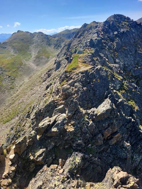
The hardest part of the comb
We come to the most difficult part of the entire journey, where the ridge narrows and is really rocky.
Behind the rockeries
We finally have the rock gardens behind us and are now climbing back up quite comfortably.

Grassy plateau
At the end of the climb, a grassy plateau awaits us almost unexpectedly.

View into the saddle
From the grassy plateau there is a view of a shallow saddle, where llamas were grazing during our visit – almost like being somewhere in South America

In the saddle
There is a crossroads of hiking trails in the saddle. From here you can continue to an even higher peak – Elferspitze, or descend through the valley back to the start of this circuit.