Trip to Sharaf al Alamayn Pass
The prospect of two different worlds


The Sharaf al Alamayn Pass (2,036 m above sea level) lies on the main mountain ridge not too far from the Jebel Sham mountain. A road connects Al Hamra in the south with the villages in the north. From Al Hamra to the pass there is a good asphalt road. On the other hand, only gravel intended for off-road vehicles. The trip is enriched by a short hike along the ridge with lots of beautiful views of the depths on the north side of the ridge
Road to Sharaf al Alamayn Pass
The road to the pass starts just east of Al-Hamra. It goes on a nice asphalt on the long southern slopes of the mountains.

View of the ridge
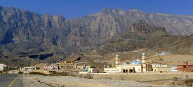
After about half an hour of driving and overcoming a series of curves, the view of the main ridge will open. The transmitter antennas that are visible from here are just a short walk from the pass. In the background Jebel Sham

Just below the pass
Just below the pass at an altitude of almost two thousand meters above sea level is the Al Hoota Rest House, where it is possible to stay

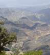
The first view into the depths
After driving through a not very extraordinary landscape, the first view from the pass on the other side will definitely get you. Below you is basically a kilometer downhill slope and a number of jagged ridges

In the Sharaf al Alamayn pass
There is a small car park right in Sharaf al Alamayn Pass. From this point of view, it is beautiful to see the possibility of a nice hike along the ridge

Road north to Bilad Sayt
The road to the north no longer has an asphalt surface and is intended only for off-road vehicles. If you have a good vehicle it is definitely worth driving it

Looking back at the pass
From the pass, we set out for a pleasant walk along the edge of the ridge along a terrain path leading to the transmitter

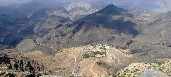
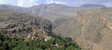
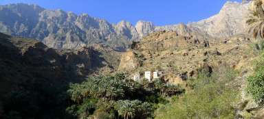
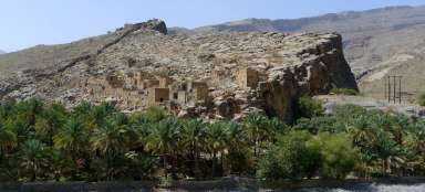
The village of Hat
Directly below us is in a beautiful place the village of Hat (sometimes referred to as Al Hajir)

Road to the transmitter
The path of the walk is comfortable, you just have to avoid the locals, who can only go there by car.

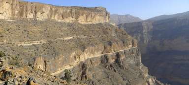
Panoramas like on the Grand Canyon
The views here will remind you of the famous Grand Canyon

Relax on the edge
There really is nowhere to hurry here. Just climb the rock plate and enjoy the views.

Viewpoint behind the transmitter
It pays to walk behind the transmitter, because from here there is a really impressive view of the edge of the ridge. But the journey continues even further, as it is the Omani trekking route W10h leading to the crossroads of routes W8 and W9 leading to Bilad Sayt or Misfat al Abriyeen

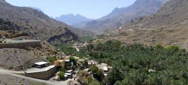
View of the famous village of Bilad Sayt
Bilad Sayt, destination of off-road vehicles

Way back
Return to Al-Hamry. The trip to the pass was definitely worth it.

Articles nearby


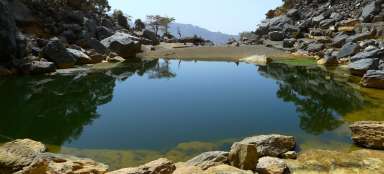


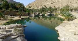
Giga List: The most beautiful trips in Oman
In Oman you can make a number of beautiful trips. Both short hikes through the valleys to amazing swimming lakes and tours of… continue reading