Hike Thame - Lungdhen
Acclimatization stage


Less than ten kilometer long route through the valley of Bhote Khosi from Thame (3 800 m asl) to Lungdhen (4 380 m asl) seems to be very short distance for the whole day. But if you are not yet sufficiently acclimated, it is more reasonable to accommodate in the previous village – in Marulung (4 150 m asl), avoid altitude sickness and have one additional day to prepare for the crossing of five thousand high pass Renjo la to Gokyo. The trail still leads along the old trade route with salt to Tibet over the infamous pass Nangpa la.
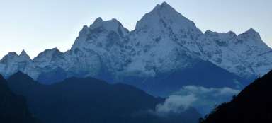
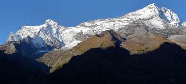
View of Thame from the moraine
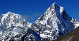
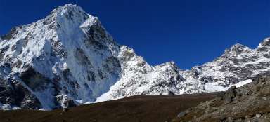
Right at the beginning of this stage awaits you a short warm-up ascent to the ancient moraine above Thame surrounded by six thousand high giants, from where you will have this entire agricultural village at your fingertips. A short distance from here leads the path to the local monastery, which you've probably already visited the previous day.

View of Thame from the moraine
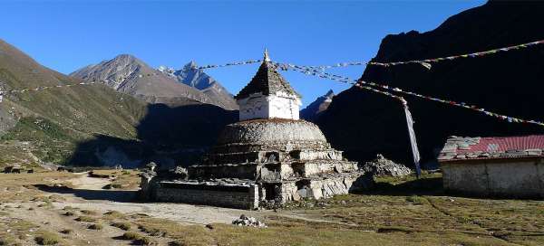
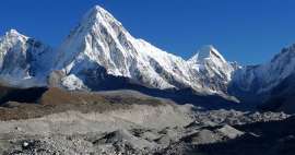
From the moraine there is a nice view also to the other side. Below you is another nice village and chorten /see the introductory picture of the photoreport/.

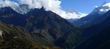
The path through the valley of Bhote Kho
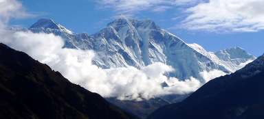
The path through the valley of Bhote Khosi rises only slightly and for a long time. When you turn back, you will see the ridge of six thousand high mountains above Thame. Compared to other valleys in Khumbu you will not meet here a single tourist. So it's a popular option for those who do not like trekking/travelling in crowds.

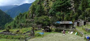
Before Taranga
Taranga (4 020 m asl) is the last major village in the valley, but beware – there are no lodges, so it is really wise to accommodate on the way from Namche Bazar in Thame. There are then only three settlements in this valley, where you can also stay – Marulung (4 150 m asl), Lungdhen (4 380 m asl), which is significantly closer to the whole-day ascent to the pass Renjo la. Then a small village Khusum (there are even two lodges), but it is already behind the turning to the pass Renjo la. Although you slowly overcome the line of four thousand meters above sea level, there are not yet any views of the glaciated giants. Everything is hidden behind smaller black ridges.

Marulung
Behind Taranga starts less interesting part without any mountain views. Then awaits you only bridge across the river and the entrance to Marulung, which is divided into two parts – the lower and the higher.

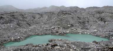
Under the moraine of the glacier Lumsumn
If you want to go for acclimatization trip from Lungdhen, you can try the path through the valley of Bhote Khosi. But the landscape is pretty dismal, especially in bad weather.

Articles nearby


Article: Three passes BC Everest Trek
Trek over three passes (Renjo la, Cho la and Kongma la) leads you through more challenging, but very beautiful and far less… continue reading
Giga List: The most beautiful stages of the trek to Everest
The highest mountain in the world, Mount Everest, is located in Sagarmatha National Park, located in the Khumbu mountain region.… continue reading