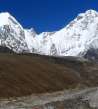
Hike Dzonglha - Lobuche
Beautiful view of Chola Tsho


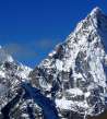
After a very demanding crossing of Cho La pass with a tiny glacier follows this easy stage with very nice views of the beautiful pyramid Cholatse (6 440m asl) and Chola Tsho lake directly under it.
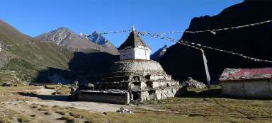
Lodges in Dzonglha and Cholatse
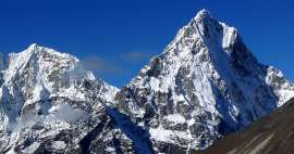
Mornings are very cold in Dzonglha (4836 m asl), but if the weather permits they are very beautiful at the same time. Also directly above the lodge protrudes nearly two kilometers long side of Cholatse (6 440 m asl). Even the other peaks on the ridge do not look bad. After looking to slowly spotlighting peaks you have no choice but to set off for the next walk.

Cho la Khola
From the lodge the path descents slowly to about (4750 m asl), where you have to overcome Chola Khola rivulet across the wooden little bridge. Of course,, with a never ending view of Cholatse.

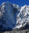
View to Cho la pass
You continue further roughly along the contour line and the further you are, the more opens the view of Cho la pass that looks pretty rough from here – a glacier among the sharp mountains

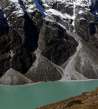
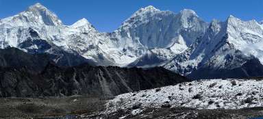
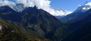
Ama Dablan on the horizon
After a while you come to another amazing outlook. Far below is the Chola Tsho lake (4590 m) and as if directly from it protrudes nearly two kilometers higher the top of Cholatse. The path over the lake leads about 40 minutes and you can not stop looking around here. At first outlook to the „main“ valley opens a lovely view of Ama Dablam (6814 m) and several other icy shields.

Small valley from Lobuche peak
A little farther on, unfortunately, you must exceed the lateral valley of the river that carries water from small glaciers of Lobuche East mountain (6,090 m asl). So that means fifty vertical meters down and the same back again. At the end of this tiny side valley you can sometimes see „discreetly“ built tents, so there some alternative paths leading to the top.

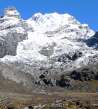
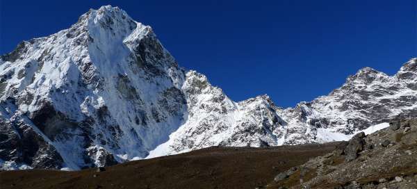
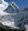
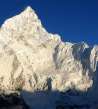
Amazing spike of Cholatse
A reward in the form of even more beautiful outlooks than before follows after a short ascent. Above all, again of Chola Tsho lake and amazing spire of Cholatse.

View of the valley
Also the outlook to the „main“ valley is worth it. In the distance is the village Pheriche (4240 m asl) and the Himalayan horizon start behind it.

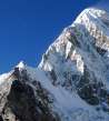
First look at the couloir
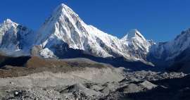
Tourists are mostly astonished of Pumori (7,165 m asl), which peeks here out for first time. This is really amazing pyramid.

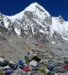
Lodges in Lobuche
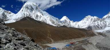
The way continues on the traverse path along the slopes of Awi Peak (5245 m asl) and after a while at the moraine the way links to the main „commercial“ path leading from the bottom. So here ends relative privacy. Next walk along the moraine is not so funny, so everyone is happy to see a village Lobuche (4938 m asl) in front of him.

Lobuche
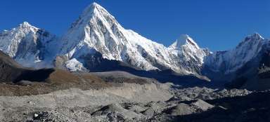
When time is good, it's ideal to have only a lunch and admire the view of another of the giants – impressive Nuptse (7,864 m) here, and then set off further to Gorak Shep. Alternatively, have a rest here before the long crossing of the pass Kongma la to Chhukung.

Articles nearby


Article: Three passes BC Everest Trek
Trek over three passes (Renjo la, Cho la and Kongma la) leads you through more challenging, but very beautiful and far less… continue reading
Giga List: The most beautiful stages of the trek to Everest
The highest mountain in the world, Mount Everest, is located in Sagarmatha National Park, located in the Khumbu mountain region.… continue reading