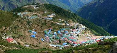
Hike Namche Bazar - Thame
Beginning of journey through valley of B


Journey to Thame (3,800 m asl) from Namche Bazaar can be for someone only acclimatization day trip, for others start of the trek of three passes leading through the valley of Bhote Khosi to the pass Renjo la (alternative way to Gokyo) or to more expedition-related hikes leading to the pass Nangpa la or through Tesi Lapcha to the valley ofRolwaling. Anyway, it's a very pleasant walk full of nice views of the mountains and picturesque villages along the way with minimum of other tourists, which is not usual in the Everest area.
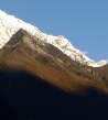
View of Kongde Ri
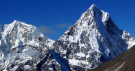
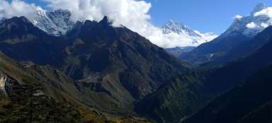
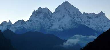
The way from the center of Namche Bazar to Thame leads first to the west around the local gompa to a rocky promontory above the valley of Bhote Khosi – the first great outlook of Namche Bazar with Thamserku and Ama Dablam on the horizon, also of Kongde Ri directly above you and the glaciated ridge of Rolwaling.

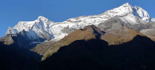
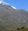
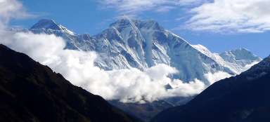
Mountains range Rolwaling
Not glaciated peak directly above Thame is Sunder peak (5 368 m asl), where leads also the tourist trail. Much higher reaches the glaciated almost seven thousand meters high Tengi Ragi Tau (6 938 m asl).

The path along chortens
The path leads from the beginning in traverse and unexpectedly slowly descends towards village Phurte. This valley is strongly Buddhist, so you can see on the way a lot of chortens and mani walls.

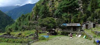
The village Phurte
The village Phurte (3 390 m asl) is only a few farm buildings with small fields around.

Valley of Bhote Khosi and Thamo
After passing the side valley of Thesebu Kholi you will ascent to the promontory, from which you will see the intermediate destination of this stage – bigger village Thamo with the famous monastery. The valley extends here unexpectedly up and the river looks just as small rivulet in such a huge rocky riverbed. Along the way you can meet monks heading to Namche, probably for shopping. Unfortunately, the glacial peaks disappear over the horizon of the lower ridge.

Thamo
After about two hours walk from Namche Bazaar you come to larger village of Thamo (3 440 m asl) renowned by a nice gompa. If you set out from Namche very early at dawn, it is the ideal place to have a breakfast.

Samde
In Thamo you will have to climb the steep stairs to the monastery, but the continuing way is not so steep. Kilometer and a half behind Thamo is another village – Samde (3 610 m asl).

The confluence of rivers below Thame
The path continues to rise up to the outlook point at about 3 700 meters asl, from where it is clearly visible how water grinded the ancient glacial moraine. Landslides are sometimes also quite massive. It is slowly possible to see to the valley of Thame Khosi, where leads the way to famous pass Thesi Lapcha.

At canyon of Bhote Khosi
The path from the outlook point drops unpleasantly down to the river, which pushes its way through very narrow gorge. All around are beautiful Buddhist paintings.

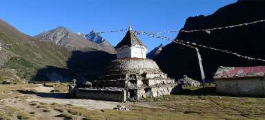
Thame
From the bridge over Bothe Khosi follows a steep hike to the ancient glacial moraine. After 150 vertical meters you find yourself on the agricultural plain divided into individual pieces by the walls. After about four hours you will be at the destination in Thame (3 800 m asl). Views of the surrounding peaks are worth it.

Articles nearby


Article: Everest View Trek
Everest View Trek (or Namche Bazar trek) is a basic introduction to Khumbu area. It is suitable especially for those who are… continue reading
Giga List: The most beautiful stages of the trek to Everest
The highest mountain in the world, Mount Everest, is located in Sagarmatha National Park, located in the Khumbu mountain region.… continue reading