Col dala Piëres (2747 m)
One-day hike in the Dolomites


Piëres (2747 m), which takes up a whole day and rewards visitors with 360 ° spectacular views of the surrounding Dolomite hills, is a moderately challenging hike to Mount Col. A cable car will take you to the first saddle to the Almhotel Col Raiser, from where you have to go on your own. Watch the time for the way back by cable car, because the last cabin leaves at 17:30. Otherwise, a 500-meter descent awaits you down to the car park.
Start by cable car
The start of the route leads from the town of Santa Cristina, where the Col Raiser cable car starts. You can park here (approx. 5 € for the whole day). The cable car will help you overcome the ascent from 1500 m above sea level to about 2100 m above sea level

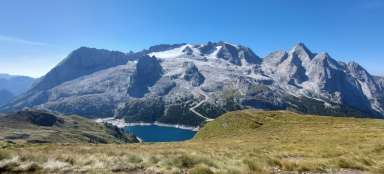
View from the top of the cable car
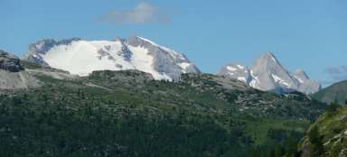
You can buy the cable car one or both way. At the top, there will be views that will accompany you throughout the day and just improve. From the Almhotel Col Raiser you can see across the valley where the town of Santa Cristina sits, as well as the rock massif and another popular destination of the Punta Dantersasc hikes with a height of 2820 m.

Upwards
We turn right from the cable car, pass the Regensburger Hütte hut and continue up the Troi dla Piza. Gradually, the path changes from a picturesque green landscape to a more rubble.
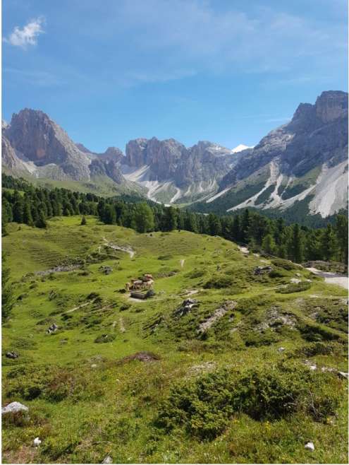
Milky on pasture
Before the start of the ascent, you pass several more alpine pastures with cows, which are like from an advertisement for Milka chocolate. And the panoramas behind them only add picturesqueness to the whole scenery. Their ringing bells will ring for several more kilometers.

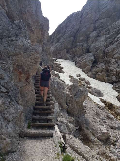
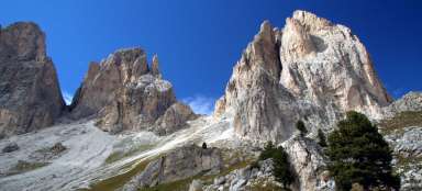
Ascent through a rock massif
After about an hour of steep ascents towards the waist Furcela dla Piza – Pizascharte (2489 m), wooden stairs begin to help to overcome the worse terrain from time to time. Somewhere in better shape, somewhere in worse condition and chains to hold on to. Occasionally there are snow fields here in July as well.
Furcela for Pisa - Pizascharte (2489 m)
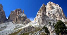
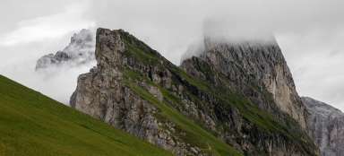
The Furcela dla Piza – Pizascharte pass (2489 m) is iconic for its rock cone, which rises sharply from the wall and also beautiful views of the opposite rocks of the Odla di Funes at 2800 m above sea level. cable car.

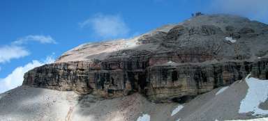
La Pisa (2555 m)
After a challenging climb, you need to relax, dry your T-shirts and replenish your energy. After passing the pass, we made a short detour to the right sitting peak of La Piza (2555 m), where we took a break and enjoyed the incredible views.

Views during the break
During the lunch break, we had a 360 ° view of all the hills around us. The most monumental is the entire rocky mountain range with the peak of Ciastel de Chedul (2426 m).

On the way to the top of Col dala Piëres
From our station we have to go down a bit back to the saddle and continue with a gradual ascent along the edge of the rocks towards our present destination Col dala Piëres. The sharply bent rocks look as if someone has broken them and tilted them. The advantage is that we walk in the lee and so it is pleasantly warm even at such a height.

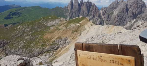
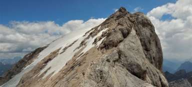
Col dala Piëres
After about an hour and a little climb we finally reach our destination and that is Col dala Piëres (2747 m). Above you will find a cross with a statue of Christ and a top book where you can subscribe.

On the top
The top photo must not be missing. The views here are also amazing. There is a complete deafening silence, no one anywhere, just occasionally circling birds in the wind. And just a descent in front of us.

Views down the road
The first part of the descent is completed by a relatively steep descent through the rubble, probably not to whom trekking poles would suit. But it can be done slowly without them. We pass the Furcela de Forces de Sieles pass (2505 m), where the road divides, but we continue further into the valley along the Alta via n.2 delle Dolomiti.

The valley back to the cable car
We continue with only a slight descent through the valley along the Rio Cisles along the UNESCO Dolomites Geotrail 5 and past the Regensburger Hütte.

La Canseles (2718 m)
We walk through the valley between two massifs, on the right our goal of the day and on the left La Canseles (2718 m), which made us a backdrop on the descent route. Walk around the Regensburger Hütte hut and back to the cable car and down to the parking lot, who doesn't want to step 500 high below the cable car like we should take the time to catch the last cabin at 5:30 p.m.

Articles nearby


Giga List: The most beautiful hikes in the Dolomites
The Dolomites are considered one of the most beautiful mountains in the world. Massive rock massifs with fairytale rock towers… continue reading