Alps 2 Ocean cycle path
Bike path from Mt Cook to the Pacific Ocean

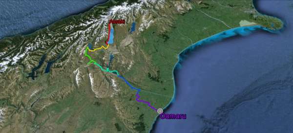


Alps 2 Ocean is a world-famous cycling route in New Zealand, connecting the highest mountains in the Aoraki / Mt Cook National Park and the Pacific Ocean. The total length of the route is a little more than 300 km and the average cyclist can handle it in 4–6 days.
A land of many possibilities
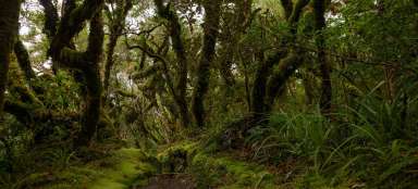
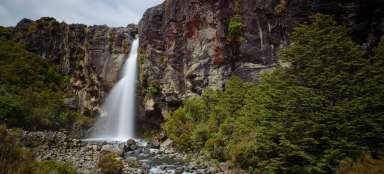
New Zealand offers many cycling routes for families, amateurs, advanced, and professionals. Trails, downhill runs, bike parks, all in incredible scenery. Just get on, pedal and once you find yourself among the mountain peaks of national parks, circling lakes and rivers, or breaking through the wilderness of rainforests. The central part of the South Island, in turn, offers a literally desert landscape and, of course, New Zealand also has beautiful beaches. The possibilities are endless, you just have to choose what you just want.
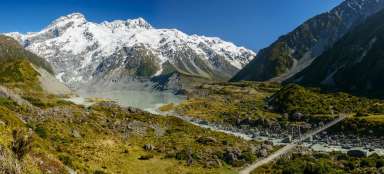
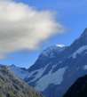
Views of New Zealand's highest mountain
Road lining the western shore of Lake Pukaki overlooking Mt Cook or the Maori Aoraki.

1 day
Along Lake Pukaki
The official route leads along the eastern side of Lake Pukaki, but it is necessary to use a helicopter, because the route crosses a branched river after 8 kilometers on a gravel path. The price is $ 250 if you go solo, or $ 125 if you go in a group. Helicopter flights must be booked in advance. If you want to save, you can continue along the western side of the lake along the asphalt main road to the end of the lake, where you can again connect to the official route. The road on the west side is slightly undulating but there are no difficult climbs. It is 61 kilometers from the start of the campsite behind the village of Mt Cook to the information center at the end of Lake Pukaki.
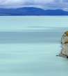
Lake Pukaki
The lake is as blue as the sky and is full of glacial water.

Day 2
Lake Pukaki -> Lake Ohau
The landscape in this section is significantly different from the first part. On the first day, you basically walk along the lake all the time, but this part of the route is more diverse. But one thing stands out from the others – there are countless arrows. These line a substantial part of the entire route to the ocean. Lake Pukaki is 10 km from Twizel and you go slightly downhill through the Mackenzie Basin. Then continue along the asphalt road along the canals, which, by the way, also farm salmon, until you reach Lake Ohau. There is a forest or gravel path around the lake, which later connects to the tarmac that continues to the Lake Ohau Lodge, where you can sleep. In total, it is 50 km from the start of this stage.
Darts
Who likes rosehip tea will be in seventh heaven.

Marking on the route
The route is well marked with such signs, so you will find it very difficult to get lost.

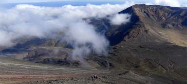
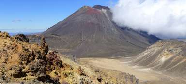
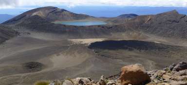
Day 3
Lake Ohau -> Omarama
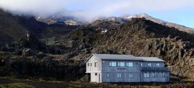
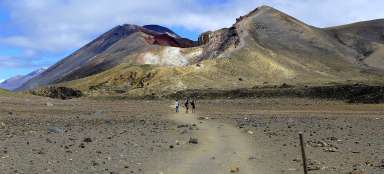
The most challenging section awaits you right at the beginning of this stage and is an 11-kilometer climb to the highest point of the entire route at an altitude of 900m. Get ready for a rocky route, where in some sections you may even suppress the bike, but if you have enough strength, it can be easily trampled. You will be rewarded with beautiful views of the surrounding countryside, Lake Ohau and Mount Ben Ohau just above the lake. And of course the subsequent descent, almost until the end of this stage :) It is definitely worth taking a small walk to the so-called clay cliffs, about 10 km before the city of Omarama. The length of this stage from Lake Ohau to the city of Omarama, even with a walk to the Clay Cliffs, is 57 km.
The highest point on the entire route
Stepping up is not easy at all, but you will be rewarded with beautiful views.

Views of Lake Ohau and Ben Ohau Peak
One of the most beautiful views you can see in Zealand.

Day 4
Omarama -> Aviemore Dam
The beginning of this stage is flat or slightly downhill and passes Lake Benmore, at the end of which stands an 823 meter long dam with a power plant. From this place you start to climb to the Otematata saddle, then you can relax in a six-kilometer descent to the town of Otematata. Then you will have to walk to another dam, between Lake Benmore and Aviemore. It's a short but steeper climb. The route then stretches again along a straight line along the lake, whose shores hide several campsites suitable for overnight stays, whether in a tent or in a car. At the end of the lake there is another dam and the odometer stops there at 55km.
Reservoir on Lake Benmore
The hydroelectric power plant that stands here is the second largest in New Zealand.

Day 5
Aviemore Dam -> Duntroon
This stage is probably the most comfortable, you are slowly approaching the ocean so it is still slightly downhill. The first 10–15 kilometers are on asphalt and the rest along the river Waitaki on a gravel / forest path. In case of an elevated river level, there are several access roads on the route that will take you to the main road, from where you can safely cross to the destination town of the stage, to Duntroon. The length of the stage is 45km.
Day 6
Duntroon -> Oamaru
The last stage and the last 58km, which separates you from the Pacific Ocean. At the very beginning, don't miss the so-called Elephant Rocks, which look like elephants but also other animals. There are two slight climbs and many turns on the route. But the whole route is very well marked, so you should not get lost. You will also walk through the former Rakis railway tunnel, behind which there is a nice descent slowly continuing to the finish line, where you still have to intertwine with the alleys of the steam punk town of Oamaru.
Elephant rock
This place looks like a herd of elephants, but those who have a good imagination will find other animals there, such as this whale :)