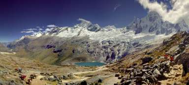
Hike in Quebrada Ulta
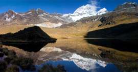
The valley below Huascaran


The descent through the valley Ulta to Carhuaz is rich not only in scenes from village life at the foot of Cordillera Blanca, but also in views of the highest mountain in Peru Huascaran. But the walk is very long, about 30 km from Base Camp Olimpica and even if you walk practically all the time downhill. If you do not want to go all the way on foot, you can try to hitchhike. But the bus lines in the direction of Carhuaz go only early in the morning.
Sunrise in BC
Before you pack the tent and set off from Base Camp back to civilization, you will certainly enjoy the beautiful sunrise.

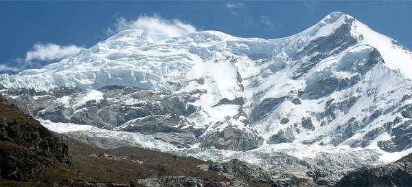
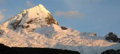
View of Huascaran
If you arrived to Base Camp on the path from the pass Punta Olimpica, you will be surprised by the descent path to Ulta Valley through quite thick „horror“ woods full of twisted trees. After about an hour walk from Basecamp you finally climb out of the woods and get to the pleasant plain (at about 3980 m asl) overlooking the walls of Huascaran – an ideal place for a snack. You can undertake a hike through this valley called Quebrada Matara and move to see Huascaran better.

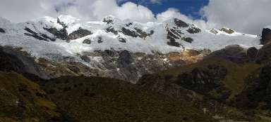
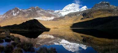
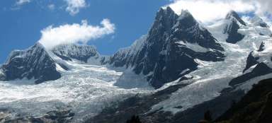
Quebrada Ulta
Just a few hundred meters from the plain with views of Huascaran you get to the bridge over the river, where can join to the road leading to the pass Punta Olimpica. Now you can hope to hike someone. But the traffic is very weak here and even the two buses that pass here in the morning do not have to stop. So be prepared for a possible long walk up to Carhuaz. The view to the widest part of the valley opens after a short walk.

Meanders
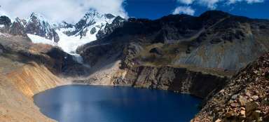
This part of the valley Ulta is a paradise for cattle – offers plenty of water and pasture. Although it does not seem so at first sight, this part is practically flat for more than 6 km. In the middle there is turning through sharp winds directly up to the lagoon Huallcococha ( 4350 m asl).

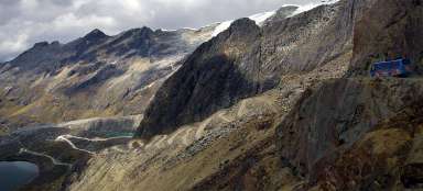
View of Nevado Ruricocha
From this side looks Ruricocha the most monumentally.

Huascarán
After about an hour wandering through a wide valley you find yourself in a small side canyon, through which you can see up to Huascarán.

View of the canyon
Now begins a little boring part of the walk, because there is not much to see. After an hour opens the valley and you can slowly begin to see on the horizon the neighboring mountain Cordillera Negra.

Winding paths
At the winding path drops the path below 3,500 meters above sea level and the world of boxes starts. From this point also begin the classic „back“ views of Huascaran. However, if you are lucky and Huascarán is not hidden in afternoon clouds.

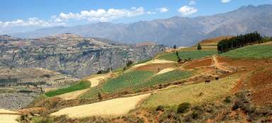
Hills full of fields
The surrounding ridges must be very fertile when they are completely covered with fields.

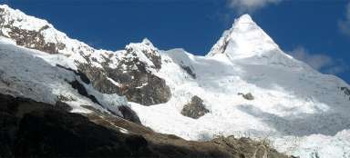
Two Huascarans
Huascaran are actually two mountains divided by a strong pass at a height of over six thousand meters above sea level.

The village Shilla surroundings
After a while start scattered simple rural buildings.

Boxes up to the edge of the abyss
Practically every suitable free place is cultivated. Farmers just have to be careful :-)

Eucalyptus groves
There are eucalyptus woods in a lower positions and close to the water. Mountains begin to be already slowly on the horizon.

Look back
At last the outlook you may be amazed how far you've already walked. Exactly in the right there is a significant “V” cut in wood – this is entrance into the mountains interior and into Quebrada Ulta.

The outlook of Carhuaz
After more than an hour descent from the village of Shilla you can finally see Carhuaz ( 2645 m asl) from the outlook point. There you can accommodate or return back to Huaraz by frequent buses.

Articles nearby


Article: Olimpica trek
Olimpica trek belongs among the shortest in the mountain range Cordillera Blanca. But this does not change much about the fact… continue reading