Drive Bunar das - Dimroi
From Indus to the start of Diamir trek


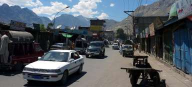
The village Bunar das (1 122 m asl) is the starting point for the trek to BC Nanga Parbat Diamir face. It is about 23 km away from the bigger Chilas. Unlike Chilas there is neither a hotel nor a restaurant, only a few needy shops on the main road, where you can at least arrange deposit of excess baggage. From Bunar das leads also a dirt road, suitable only for off roads, for another 13 kilometers through arid valley to the village Dimroi (1 600 m asl). So even if prices are exorbitant, most of the tourists choose here the terrain vehicle.
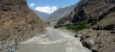
Indus valley at Bunar das
Indus valley is very arid in the vicinity of Bunar. But just before the village is a bridge to the other side of the river leading into a small oasis.

Small oasis
Small oasis was created along one of the many rivers flowing down from the southern slopes of 4–5 thousand high mountains between Chilas and Gilgit.

Bunar das
The village Bunar das (1 122 m asl), the basis below Nanga Parbat from Diamir side, is a true backwoods. Apart from a few shops there is nothing at all. Anyway, if you've not arranged the transport already in Chilas, you will have to bargain here with the drivers of old Toyotas.

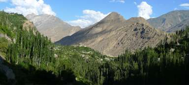
The entrance to the valley
After you set out on foot or better by jeep, you can expect a short passage through the village and behind it already desolate and arid valley.

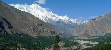
Looking back to Indus valley
The road is very narrow. Looking back, it is nice to see the wide valley of Indus and arid plain around the river.

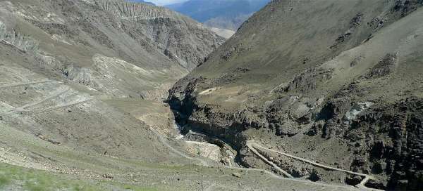
Irrigation canal above the gorge
An interesting part of this road is a passage, where the river disappears in a narrow gorge and space is taken up also by an irrigation canal.

The road of death
At the irrigation canal you will cross the bridge to the other side of the valley and begin to ascent steeply up the hillsides, see the introductory slide of the photoreport. Soon, you will be well above the valley bottom and maybe you will pray that the driver manages the ride :-)

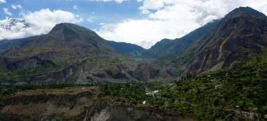
Way above the valley
The road then leads for long kilometers in traverse high above the river. If you decide to walk this stage on foot, so this is the most demanding passage. Almost all day it's exposed to the scorching sun with no shade.

The confluence of rivers before the vill
The destination of this road stage is slowly approaching – a village Dimroi. Just before is the confluence of rivers, which are separated only by a worn narrow rocky headland for tens of meters.

Before Dimroi
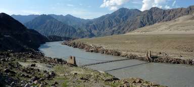
Before the village Dimroi you have two options – either take a jeep for a kilometer to get to the bridge at Halali and then walk back to Dimroi, or descend the slope to the river and use the cableway to the other side.

The river before Dimroi
When you descend to the river, you will find out that it practically impossible to wade through it and you will have to bargain with locals for the ride in the cable car.

The cable car to Dimroi
Ride in the cable car is a great experience. But haggling for the price with crowds of locals is quite unpleasant.