KV Raise trip from Lázně Bělohrad to Zvičina
Hike from the spa to the highest peak in the Giant Mountains


The most famous tourist route from Lázně Bělohrad is along the yellow tourist route to the highest peak of the Krkonoše Mountains – Zvičina, the so-called KV Raise Road. The route is over 11 kilometers long and 400 meters high. When calculating and on the way back, it is already quite a long one-day hike.
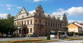
Belohrad Spa
The start of the tour is in the picturesque town of Lázně Bělohrad. The hiking trail leads directly through the center along the main road and then disconnects to the village of Brtev. If you have more time and energy, you can take a tour of the city in the beginning
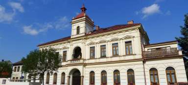
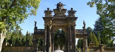
A tour of Belohrad Spa
Relaxing circuit through the picturesque spa
Belohrad Spa is a small town in the foothills of the Giant Mountains with several attractions. You can make a… continue reading


For Brtví
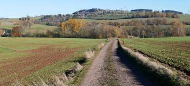
After passing Brtví, you finally get out of civilization and slowly climb the direction of Vřesník along a dirt road. In addition to hiking trails, there is also a marked bike path, where a mountain bike is more suitable.

View of Hořický Chlum
Just below Vřesník, the view opens up to the long Hořický Chlum with the highest peak Chlum (449 m).

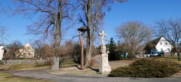
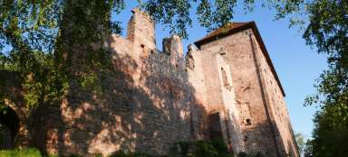
Monument to the fallen in Vřesník
After about 3.5 kilometers of walking from Lázně Bělohrad we arrive in Vřesník, an alternative start for a shorter version of this tour.

View of Sněžka
At the end of the village Vřesník there is a nice lookout point, not only to the surrounding hills with historic fortifications, but also to the distant Sněžka – the highest mountain in the Czech Republic.

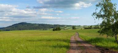
Descent to the valley of Bystrý potok
There is a farm at the end of Vřesník, so you can come across cows here in the summer. The descent into the valley of Bystrý potok is accompanied by picturesque views of the hills of Valy (489 m) on which once stood the fortified settlement of Kal and Homolka (465 m). Under favorable conditions, the descent can be shortened across the meadow (little noticeable footpath)

The valley of Bystrý potok
We will meet at the bottom of the valley, where there are several buildings, and along the narrow road we will continue through the valley towards the road junction. Above us to the north are meadows and a small protected area – Natural Monument Homolka

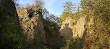
Borek
We will leave the valley of Bystrý potok at the crossroads and continue in the direction of Bezník / Borek along a slightly busy road. In the forest there is a turn to Borek, which lies almost 500 meters above sea level. In Borek there is a small bell tower, a cross and the famous bench Rais' peace

Rais' calm in Bork
Rais's calf is a beautiful stone arch bench

Hike around Vyšehrad
A very nice short walk around the Vyšehrad hill (585 m) begins in Borek, half of which we will walk as part of this tour.
Walk around the hill Vyšehrad
Beautiful views not only of Zvičina and the Giant Mountains
Vyšehrad (585 m above sea level) is an indistinct peak just west of the famous Zvičina hill in the foothills… continue reading


From Borek to the village Zvičina
The road from Borek thus ascends to a hill (504 m), where there is an entrance to a small underground shelter. Then around a picturesque building with a protected lime tree – Lípa v Podemládí. Then it climbs along the southern slopes of the Vyšehrad hill to the road over the Zvičín ridge – it is unexpectedly busy due to hikers going to the top of Zvičina by car. After a while, we come across a red tourist route connecting Nova Paka or Pecka with Zvičina. Here we leave the walking circuit around Vyšehrad and head further to Zvičina.

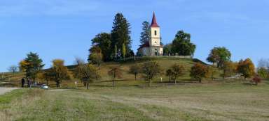
Final ascent to Zvičina
Now we have the final ascent to Zvičina with the village of the same name. The road is narrow and unfortunately quite busy, especially on nice weekends. But at the top we have beautiful views not only of the Giant Mountains. At the top is a tourist cottage and a church

Articles nearby


Giga List: The most beautiful trips from Lázně Bělohrad
The spa town of Lázně Bělohrad is a nice starting point for several interesting trips. You can start with a walk around the city… continue reading