Article Hike to Kremenec
To the easternmost point of Slovakia

The easternmost point of Slovakia and the highest peak of the Poloniny National Park, which is also located in the tri-border of Slovakia, Poland ,. Ukraine.
Kremenec
Kremenec is a mountain 1221 m high and lies in the Carpathians and is the highest mountain in the Poloniny National Park. The top of the mountain lies on the Polish-Ukrainian state border. About 200 meters from the top of the mountain, at an altitude of 1208 m above sea level, there is the Slovak-Polish-Ukrainian tri-border, where the easternmost point of Slovakia is located.
Exit
The starting point for the hike is Nova Sedlica, it is a relatively demanding long hike, which can take something between 3 and 4.5 hours to the top. From Nová Sedlice there is a relatively easy way to navigate (following the well-marked red tourist sign) to the top. At a length of about 9 km, it ascends from 400 m above sea level to 1221 m above sea level (ascent 960 m and descent 140 m).

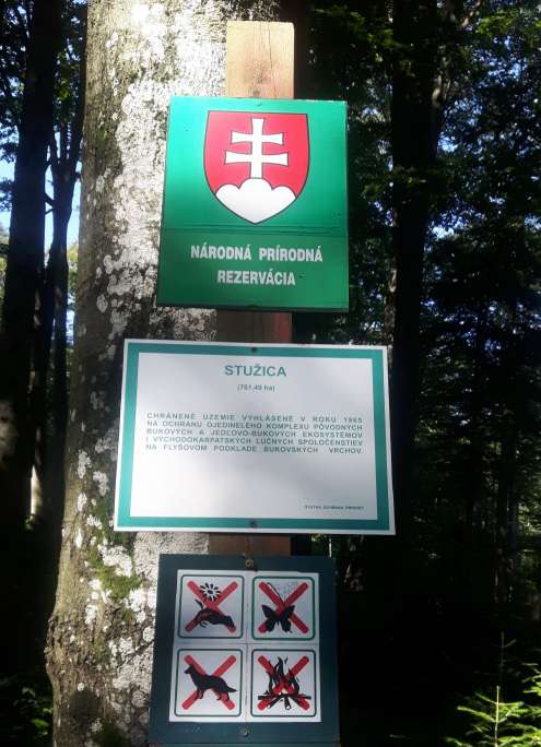
Stužica forest
The road enters the Stužica National Nature Reserve, which is the original preserved Carpathian forest, which is listed as a UNESCO World Heritage Site. It is the largest Slovak forest (761 ha), where white firs (Abies alba) grow, among others, which grow up to 50 meters and the oldest are 300 years old.
Road through the forest
The path leads along places of steep, clay and stony forest paths and trails. It slides nicely in the wet. It is necessary to cross a few streams and many fallen trees.

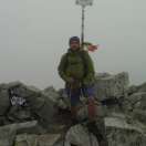
Finally the top
The last very steep ascent (trekking poles are suitable here) and you are at the top. The pleasant fact is that just below the top is a watery well, where after a challenging ascent you can refresh and water.
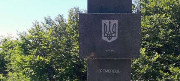
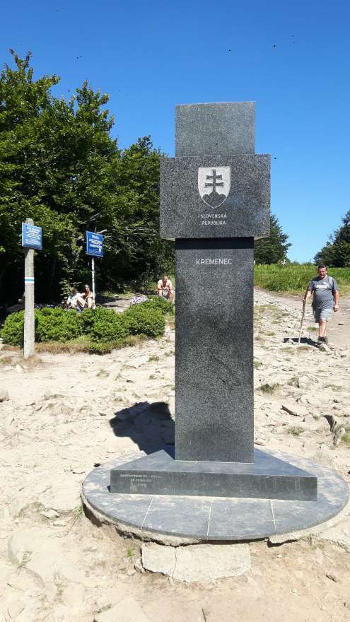
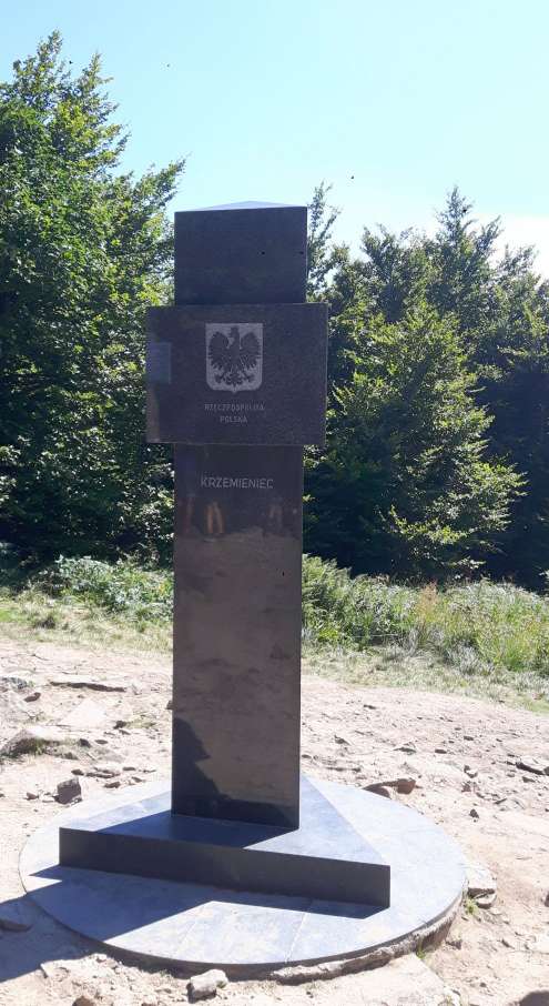
Tri-border - triangular column
The actual tri-border is marked by a distinctive triangular boundary stone. It is a place attractive for photography. Thanks to the fact that the trip from Poland is significantly less demanding than from the Slovak side, there are really many Polish tourists in the season. The column on the tri-border is triangular, so it will take quite a long time for everyone on all three sides to take a picture :-(.

Kremenec - the highest point
The exact top of the mountain lies on the Polish-Ukrainian state border about 200 meters northeast of the Slovak-Polish-Ukrainian tri-border. However, this place is not so photogenic for tourists.

Descent route
The descent is possible either by the same route or you can continue for about 1 hour to the left along a fairly comfortable ridge path of the red (blue Polish) sign to Čiertaz (1071 m above sea level). From Čiertaž it is possible to continue further along the ridge to the attractive Riabu rock (1 – 1.5 hours) and from there descend along the yellow sign. However, this variant is already quite time consuming.

Stone meadow
On the way to Čiertaž you can enjoy the local forest and enjoy the view of Poland on the ridge on the site „Kamenná lúka“, Polish Kamienna from the rock at an altitude of 1200 m

Descent through mountain meadows
The descent is quite steep and quite strenuous in places. The reward for the effort is a passage through beautiful mountain meadows.