A trip to Connemara National Park
Region of lakes, mountains and sheep


Connemara National Park is an hour and a half north of Galway, the capital of the region of the same name, in the middle of Ireland's long west coast. This whole coast is one pearl next to another and Connemara is undoubtedly at least in the first Top 5. The unique character of the landscape is guaranteed by relatively larger mountains in Ireland and among the mini-sitting lakes, where fishermen from the area come, especially in the salmon season.
Lakes
One of the basic pillars of the Connemara area is the lakes. The largest and perhaps the most interesting for fishermen is Lake Corrib, which is located just outside the town of Galway. The reason why so many fishermen go to this area, especially around June-July, is the salmon, which pull from the sea across the weirs in the town of Galway by the river to the lake, where they spawn.

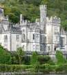
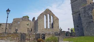
Abbey - Kylemore Abbey
Just before you enter Connemara National Park, you can't miss Kylemore Abbey, which sits on the shores of Pollacapall Lough like a ghostly white ghost. Inside, it is possible to see the period furnishings or take a walk in the surrounding gardens and promenade along the lake to the nearby Gothic church. Or who needs, just like us, to stop at the lookout on the opposite side of the lake and enjoy the view of the abbey set in the surrounding countryside.

Ascent to Diamond Hill
In Connemara National Park, we chose the ascent to Diamond hill (442m.nm), which is very well marked with a modified path, so even complete beginners can handle it. The ascent according to mapy.cz is estimated at 1.5 hours with a 375 m elevation gain. The route starts at the visitor center in the town of Letterfrack.

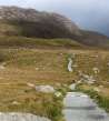
Routes to the top
The routes to the top are arranged in two circuits, where it is possible to bypass only the lower circuit below the mountain and the circuit back to the visitor center or continue to the upper circuit through the top. The road leads in some places through peat bogs and thanks to frequent rains, sections of the route are built on wooden footbridges.

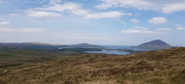
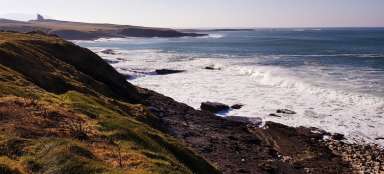
Far peak
The ascent effort is then rewarded at the top with a distant view of the surroundings of the ocean bay, islands and long beaches on one side and on the other peaks of the higher mountains in Connemara, not which, unfortunately (at least according to Mapy.cz) does not lead the way.

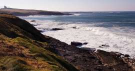
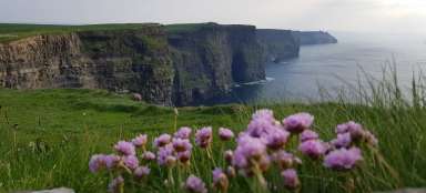
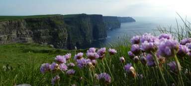
Beaches
The Connemary area has several beaches, from the smaller ones hidden in the bay to the long beaches, perfect for walks. The Irish climate is not very pleasant for swimming, but if you are hard, on warmer days, where temperatures are at 23 ° C, you can soak in the ocean or at least bask in the lee.

Irish fjord
In the north of the Connemara area, you will also find one natural phenomenon that is rather typical of the Scandinavian landscape, and that is a fjord or a long sea bay that goes deep into the mainland. This fjord separates County Galway from County Mayo, which lies further north. You can take a ride along the fjord on a boat and see it as closely as you can on a road that lines it from the south to the town of Leenaun and enjoy the reflection of the green hills in the calm blue surface.

Articles nearby


Article: Traveling in the Midwest of Ireland
The west coast of Ireland is without a doubt the most beautiful part of the country, and most tourists cannot miss it when… continue reading
Giga List: The most beautiful trips in Ireland
Ireland, an island of harsh climate on which you will find two states, the Republic of Ireland and Northern Ireland, part of the… continue reading
Article: A ride along the Wild Atlantic Way
Along the entire west coast of Ireland, there is a serpentine winding route called the Wild Atlantic Way. Whether you drive… continue reading