Hike to Sesvenna waterfall
The most beautiful waterfall in the Sesvenna Mountains


One of the biggest attractions of the Sesvenna mountain range is the beautiful waterfall of the same name. It is relatively easily accessible from the high alpine village of Schlinig – Slingia (1,726m). It is about 4 kilometers from the village to the waterfall along a comfortable hiking trail. The route leads through the wide valley of the river Metzbach – Rio di Slinga. From the waterfall, you can also continue to mountain huts and peaks.
Slingia starting route
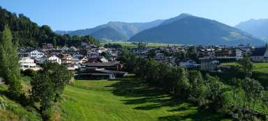
Slingia is a beautiful alpine village high above the Val Venosta valley. You can get here from Burgosia by a mountain road with several twists and turns. At the very end of the village there is a large parking lot (paid). You can go on a number of beautiful hikes from here. The most famous and probably the easiest one is towards the Sesvenna waterfall, where we will also go. There are also several accommodation options if you want to do more hikes from there, for example gasthof Zangerlehof

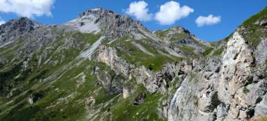
Föllakopf (2,878m)
The dominant peak on this hike is Föllakopf (2,878m), looking like a massive rock castle towering high above the valley. The summit cross can be seen even from a distance. A hiking trail leads to the top from the Sesvennahütte mountain hut, which you can also easily reach from the waterfall.

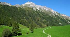
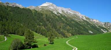
Metzbach Valley
You can go on the way to the waterfall by following two paths along the marked hiking trail on the south side of the valley or the path leading „in the middle“ through the meadows. The valley itself looks more picturesque than dramatic in this passage.

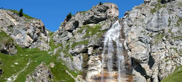
View of the end of the valley
Finally, a view of the rock wall enclosing the valley and the waterfall flowing over it opens up. The goal of this hike is already in sight.

Path through the valley
The road through the valley is really picturesque, almost kitschy. On a warm summer's day, despite the altitude, it is incredibly hot here without any shade.

Schliniger Alm - Malga Slingia
After about 2.5 kilometers of walking, there is the possibility of refreshments in the Schliniger Alm. There is also a children's corner, and people with the smallest children usually end their walk here.

Retrospect
Looking back, the more massive Ortles mountain range can be seen on the horizon

View to the south
We gradually moved from the south side to the north side of the valley, so we have slightly different views. The landscape here is really very picturesque.

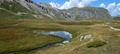
Innere Alm
The essential place is the Innere Alm. Not only is it really beautiful, there is a bench and water, but mainly the tourist routes are divided here. From there, most hikers continue on hiking trail number one up the slope, but if you follow it you won't get directly to the waterfall. So continue straight along the bike path.

Sesvenna waterfall in sight
Finally, we have a waterfall in the palm of our hands. In addition, cows in the surrounding meadows – simply an Alpine fairy tale.

By the waterfall
The waterfall is among the most beautiful thanks to the surrounding area. It is several tens of meters high.

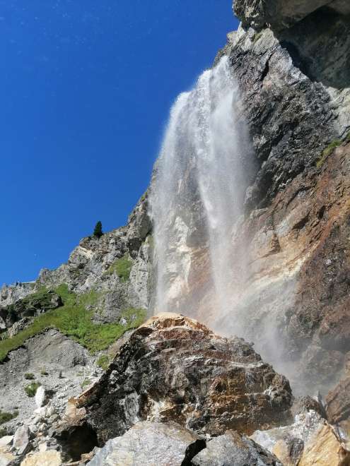
Under the waterfall
Thanks to the fact that we didn't follow the tourist route but the „bike path“ we can walk all the way to the bottom of the waterfall.
Looking down into the valley
From the waterfall you can see the whole part of the road that we walked. But the village itself is just beyond the bend of the valley. We can continue on to the mountain hut Sesvennahütte, which is also an interesting route.

Articles nearby


Article: Trip to the Sesvenna Mountains
2/3 of the Sesvenna Mountains belong to Switzerland. A small part of the mountain range also belongs to the Swiss National Park.… continue reading