Hike Bergkastel - Lake Goldseen
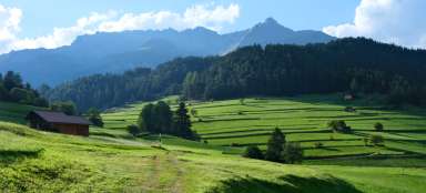
The most beautiful hike around Nauders


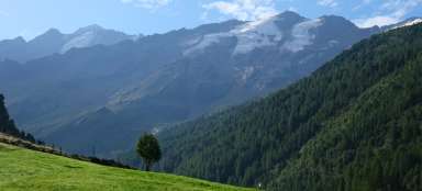
One of the most beautiful hikes around Nauders is definitely the hike from the Bergkastel cable car to the fabulously beautiful Goldseen lakes. Approximately 500 meters in height and 3.5 km in one direction await you. If you have time, you can continue from the lakes to the top of the Bergkastelspitze (2,912 m). The route to the lakes itself is not difficult, it is a pleasant mountain trail.
View of the Mitterkopf (2,750 m)
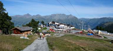
After you have taken the cable car to Bergkastel (2,170m), take route no. 33. It runs parallel to the cycling routes from the beginning. There is quite a lot of traffic around the cable car station – there is a huge restaurant, a large park for children (Goldpark) and a lot of cyclists who let themselves be taken by another cable car ending below the Mitterkopf peak (up to a height of approx. 2,500 m above sea level). After a while, fortunately, the footpath leaves busy places and leads through a sparse forest.

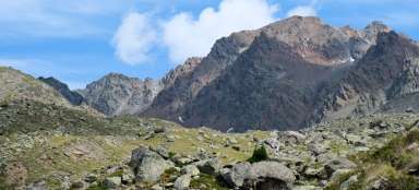
The road through the stone sea
The road suddenly bends into a gigantic stone sea. A long time ago there was a glacier here, currently a tree sometimes peeks out between the stones. More difficult sections are overcome by wooden footbridges.

A chapel above the stone sea
After crossing the stone sea, you will go above the valley of a small stream. The first arresting and partially vantage point is a small chapel.

Under the rock rampart
You slowly pass the last trees in the valley and enter a desolate world. The valley closes with a huge rock wall, which you will have to climb. So ahead of you is the biggest climb of this hike. Sometimes you will pass gigantic stones that have rolled here from the peaks high above you.

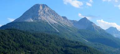
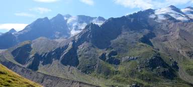
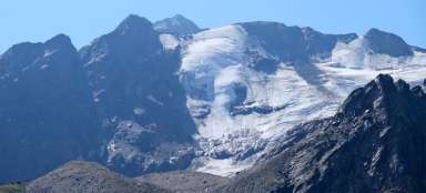
View of the Bergkastelspitze - Cima Castello
The road climbs quite steeply. About 2/3 of the way up is this flat patch of grass with a beautiful view of the Bergkastelspitze. It's all dug up by marmots here.

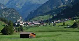
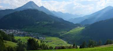
View up to Nauders
From the rock embankment there is a view of the entire desolate valley that we climbed. On the horizon you can see the cable car station and further down the Nauders. The mountains on the horizon already belong to Switzerland.

Just below the top
The highest point on this hike is approximately 2,600 meters high. There is a post with a view of both the lower lake and down to the cable car.

View of lower Goldseen lake
From the vantage point, you can see the lake about 40 meters below you. The ridge above the lake is also the border with Italy.

Lower Lake Goldseen
The lake is really beautiful, so it is definitely worth going down to it, or continuing on to the second higher lake.

Above the Lower Lake
The path to the second, higher lake is probably the most challenging part of the hike. The path basically leads over boulders and you need to follow the signs carefully. Directly below you, deep between the boulders, a small stream meets.

At Upper Lake Goldseen
The path will take you directly to the outlet of the stream from the lake. Just in front of it, the path to the top of the Bergkastelspitze branches off, to which you only have 300 meters of altitude left.

Upper Lake Goldseen
If the lower lake was beautiful, the upper one is even more beautiful.

Over Lake Goldseen
The tourist route doesn't go any further. If you want to look at the lake at least a little from a height, you have to choose a route leading up. But be very careful, it is one huge stone quarry.

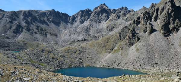
View of both lakes
The reward for the unpleasant ascent is the view of both lakes at the same time.

Wasteland to the third and fourth lakes
The way back is the same, but you can extend it a little further and see the third and fourth lakes. Just before it starts to descend from the embankment, there is a fork in the direction of Pedroßscharte (2816 m), Ganderbildspitze and Westlicher Mataunkopf. If you go in this direction, after about 500 meters you will come across the third lake, which is just a puddle. In the distance you will see lake number two where you were a moment ago and after another 50 meters lake number four.

Fourth Lake Goldseen
The fourth lake is also nice, but it is definitely not as beautiful as the first two.

Articles nearby


Giga List: The most beautiful hikes from Nauders
The picturesque town of Nauders can be found at the very western end of Tyrol near the borders with Italy and Switzerland. You… continue reading