Crossing the Retezat Mountains
Romanian “High Tatras“


Retezat is the most visited mountain range in Romania, but we can still call this mountain range unexplored by tourists, which cannot be said for a long time. Romanians have long discovered that it is easy to get money with a tourist, so when entering the mountains, permits are paid for entry and it is allowed to camp here only in designated places. It is one of the highest Romanian mountains, which is definitely worth a visit
Day 0
Rain, Rain, Rain
After arriving by train to Subcetate, it is necessary to take a taxi and drive to the cabin Cabana Gura Zlata, where the ascent to Lake Zanoaga begins, the lake is a difficult 8-hour climb, due to the storm by the lake, but we had to go down halfway to the cottage, where you can stay for 4 euros, after two days of storms, we finally decided to take a risk and skip the ascent to Lake Zanoaga and the transition to Lake Bucura, but go straight to Lake Bucura.
1 day
Arrival to Lake Bucura
On the first day of the trek we skip the strenuous ascent to Lake Zanoaga and instead can be taken by car to Poiana Peleagi, where a short two-hour ascent to Lake Bucura begins, which is one of the few allowed places for camping in the mountains, but especially from the lake multiple treks. When building a tent, it is necessary to take into account the strong wind in the area and it is ideal to use the existing tent places. On the way to Lake Bucura, the entrance to the national park is 10 RON. Since the place arrives around lunch, you can go for a short trek to the saddle towards Lake Zanoaga, or make an ascent to one of the surrounding peaks
Organic farming
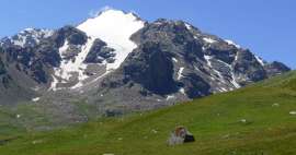
On the way to Poiane peleagi we meet a large number of sheep that graze in the woods and provide information about the typical color of the Romanian countryside

View from Lake Bucura
One of the beautiful views during the ascent to Lake Bucura

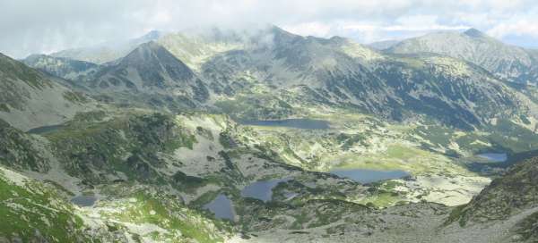
View of Lake Bucura
View of Lake Bucura, where you can see not only the tents but also the mountain service station (Salvamonte).

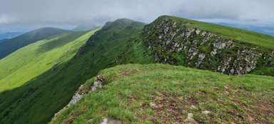
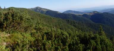
View from the saddle to the surroundings
A quick ascent to the saddle, through which one comes from Lake Zanoaga, also brings such views of the surroundings.

Day 2
Ascent to the top of Retezat
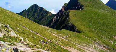
The ascent to the highest peak of the mountain range of the same name Retezat (2482 m above sea level) and the descent to Lake Bucura takes about 6 hours, on the way to the top you pass through two other peaks of Bucura II. (2378 m asl) and Bucura I. (2433 m asl). The journey is not technically demanding, I only recommend setting off in the morning, because the sky is quite fast in the afternoon. At the ascent to the top of Bucura II. it is necessary to turn a little off the road and go off the marked sidewalks.
Sunrise
The sunrise at Lake Bucura is worth landing and enjoying

View of the valley
If a person lands in the morning and goes out among the first tourists to the saddle Bucura, he will have beautiful views of the surrounding massifs, in the background to see the top of Papusa

Sunrise
Sunrise, the path along the ridge to the other side of the saddle leads to the top of Peleaga

View from Bucura I.
View towards Lake Zanoaga

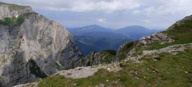
View of the top of Retezat
The view of the Retezat peak is already shrouded in fog in the morning, but when we went out to it around lunch, the sky became clearer and offered beautiful views of the surrounding nature.

Day 3
Descent
On the third day we leave the camp at Lake Bucura and start a „descent“ from the mountains, which can be made more pleasant by crossing several peaks of Peleaga (2509 m), descending to the saddle Saua Pelegii (2280 m), then ascend to the top of Papusa ( 2508 m above sea level), then continue along the ridge to the Custura saddle (2250 m above sea level) and ascend again to the top of Custura (2457 m above sea level), then only descend to the Cabana Buta cottage next to which there is also a place for camping. The trek takes all day and you need to bring enough water.
The top of Papusa
The photo is unfortunately of poor quality, but there was almost no sun during the whole day.
Descent from the top of Peleaga
Descent from the top of Peleaga and a view of the surrounding countryside, which is worth the effort.

The view
One of the short moments when the sun and the view of the surrounding countryside are shown.

Descent from the top of Papusa
The descent from the top of Papusa in the clouds is a hidden peak of Custura, the descent is in some places more technically demanding.

Descent from the top of Custura
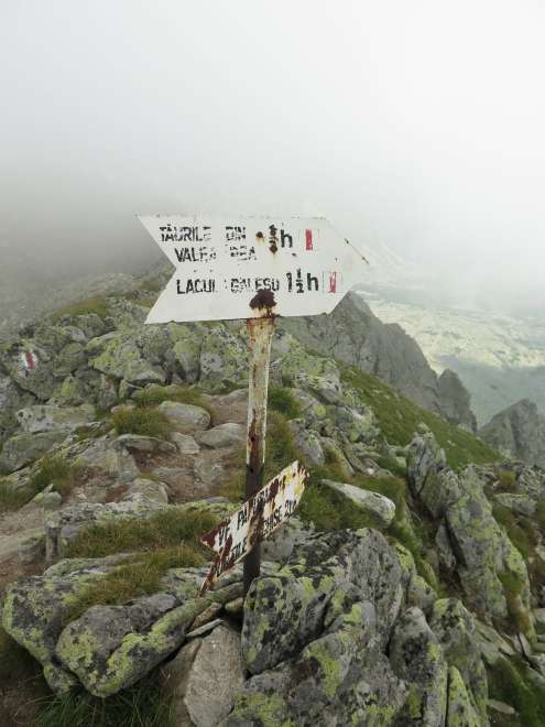
When descending, it is necessary to be aware that very often the mark is lost and sometimes appears up to an hour's journey, and then they prefer to bury them straight.

Day 5
We are leaving the mountains
We descend to Cheile Butia, which is a complex of cottages and a major tourist attraction, especially for locals. The descent takes about 4 hours, from the cottage you descend about 30 minutes to the nearest village where the bus stops. Then we leave by bus to the town of Uricani and to the town of Petrosani, from where we leave by train to the town of Deva and then by night train to Budapest.
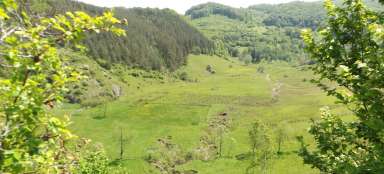
Romanian countryside
As we descend, we reach the first signs of settlement.

Recent views
One of the last views of the beautiful Romanian countryside at the end of the descent is necessary to turn from the forest road to the hiking trail, otherwise you will extend it by 1 to 2 hours

Articles nearby


Giga List: The most beautiful short treks in the world
In this overview you will find beautiful treks from around the world long from two days to one week – so-called short treks.… continue reading