Article Trek across Rarotonga
Through the island from north to south

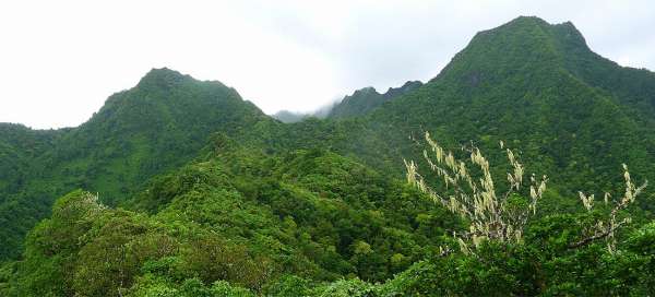


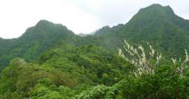
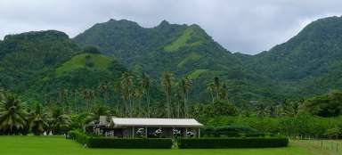
Cross-Island Track is absolutely the most interesting trip in Rarotonga. You will go across the whole island from north to south through tropical jungle during this approximately three-to four-hour lasting walk. You can also get a little wet and sometimes go in foggy clouds. Anyway, with a bit of luck you will have nice view of the highest peaks of the island Te Manga (653 m asl) and Te Atukura (638 m asl) from the highest point of the trek. Definitely do not underestimate shoes as there are a lot of slippery, muddy and even quite steep passages. It is possible to walk the trek in the opposite direction (i.e. from south to north) too, but it is not recommended as there is a greater risk of losing your way.
Tropical vegetation
The trip starts at the western end of the island's capital Avarua at Avatiu harbor. Some tourists go even a little higher in a taxi along a small road, but it is more stylish to walk the trek from sea to sea. You then need to ascent along the narrow road near Avatiu creek about 2 km to the parking lot. From here everyone must continue on his own legs. There are gardens and small houses around at the beginning. Vegetation along the way is tropically dense.

Tropical garden
Mainly flowers and green vegetation lovers enjoy the beginning of the ascent. You can see here growing wild vegetation that could be seen anywhere else in the world only in a botanical garden´s greenhouse.

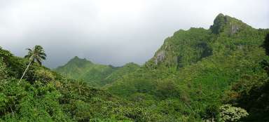
Jungle
Almost constantly damp path squeezes through thick scrubland – without mowed path it would be virtually impossible to go anywhere.

Signs in the forest
There are signs helping you with orientation.

Sharp uncomfortable ascent
The worst part of the ascent starts – the path is very steep and also completely grown through with roots. You sometimes meet here tourists just in flip flops looking quite sadly here with scuffed feet.

In the pass under the Needle
You finally ascend to the pass and from there it is only a few meters below the most famous mountain in the island – The Needle (413 m asl) – the local name is Te Rua Manga.There are perfect views of all sides of the island from here.

View of the Needle
After relaxing at the outlook point under the Needle you need to go on in the direction of the south coast of the island. After a while open a nice view back of the Needle and the outlook below it.

Descent secured with a rope
The descent is significantly worse than ascent. Muddy slope is secured by ropes with knots. After overcoming the worst passages the trip continues along the creek Papua. The creek must be overcome many times from one side to the other on slippery stones.

Brook Papua
Creek crossing is in some places almost a little adventure. It is also necessary closely watch the path in the lower part of the brook not to get to the dangerous impasse high above the riverbed.

Wigmore's Waterfall
At the very end of the forest path there is Wigmor´s waterfall. You can have a bath in the waterfall´s pool. From there it is only about 15 minutes to the road around the island. You can thus just wave to the bus or take a refreshing bath at the adjacent beach.

Articles nearby


Article: Travelling in Rarotonga
If you want to get to know Raratonga a little, you must combine not only swimming and snorkeling, but also hiking and cycling.… continue reading
Giga List: The most beautiful hikes in the world
In this overview you will find a very beautiful, the maximum one-day hikes from around the world. Not only during long treks, but… continue reading
Giga List: The most beautiful trips to Rarotonze
Rarotonga is the largest and most important island of the Cook Islands. Here you can take some nice tours to the mountainous and… continue reading