Walk to Tibetan Everest BC
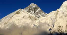
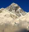
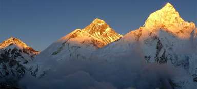
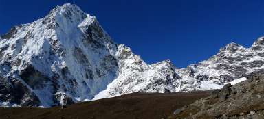
Mount Everest from the north


North Everest BC and walk around it is for someone just one of the trip destinations, but for other people it is the start of difficult trek to ABC or even to the top of this mountain itself. Anyway, compared to the Nepalese side, where it takes you a few days walking to get into southern BC, here you can easily arrive in a few hours from the nearest town by bus. It will not take long and perhaps even asphalt road will lead here as well. But even so, this stop and views of the mighty northern side of the mountain are worth seeing.
Valley of river Zakar
After overcoming an interesting Pang la pass famous for great views of the Himalayas the road leads in fertile valley of Zakar. Green barley acres are lined with picturesque villages and arid ridges. These fields at a height of up to 4500 nm belong among the highest located in the world.

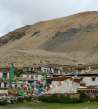
Tibetan farmhouse
Life here in the village is still straightforward as years ago.

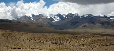
Typical Tibetan landscape
In some places is the valley very wide and you do not entirely have a feeling that you should be in a moment near the world's highest mountain – Mount Everest – called here rather in Tibetan Qomolangma.

Nearby Zangpucun
After a while you will pass the turnoff to Zangpucun through which you will most likely go after a visit to Everest BC.

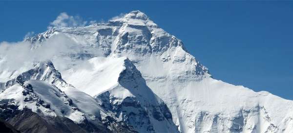
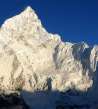
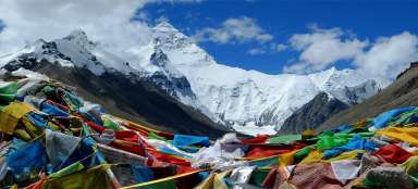
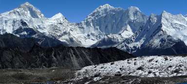
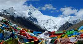
The first view of Everest
The valley turns to the south and rises toward the highest mountain in the world, which appears after a while.

Rongbuk monastery
On the way to Everest BC is also the highest located monastery in the world – Rongbuk (5 000 m asl). Rather than with its architecture it is interesting by the fact that sherpas used to organize here pilgrimages from Nepal through difficult crossing of the pass Nangpa la.

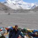
Car park under Everest
The way ends (after one hour drive through the valley) on a windy, dusty patch (5 015 m asl), where are souvenir shops and food stalls. Here you must either change to „unpolluted bus“ for extra money or walk the remaining about 4 km to BC. Walking is obviously far better option, because you can still admire the north side of Everest. Otherwise, the famous eco bus looks like a normal old piece of junk scraped 10 years ago from city transportation.

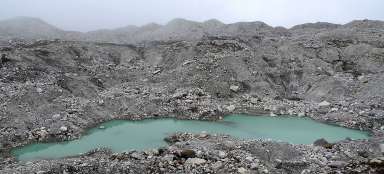
Glacial lake
At the beginning of the journey there is a long plane that is slowly rising to an old glacial moraine. After about 15 minutes walking you will reach a small pond.

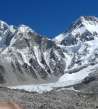
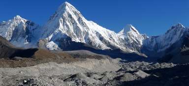
Everest BC in sight
The path continue to rise through landscape full of piles of glacial debris and shortens twists of dusty path /valley itself is not very nice/. Finally you get to the river and see buildings in BC a huge main moraine on the horizon.

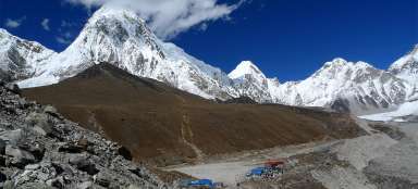
Everest BC
Everest BC (5 150 m asl) is a small patch with a mast and Chinese flag surrounded by cardboard cells and small checkpost. In summer it is quite deserted, as people trek here in April-May.

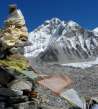
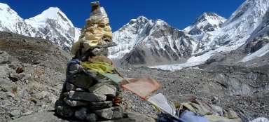
Prayer hill
After about 45 minutes’ walk from the car park is your destination /only 200 meters behind BC/ an outlook hill (5 150 m asl) looking of the glacier Ronbuk. Anyway, they will not allow you to go further unless you’re within the trekking permit.
The way back is far less interesting, because you are not looking of Everest, but just into rubble.

Articles nearby


Article: Trip to Tibet BC Everest
The trip to the Everest base camp is practically mandatory for all mountain lovers already traveling in Tibet. Long one day trip… continue reading
____Zážitek____: See the world's highest mountain, Mount Everest
Seeing the world's highest mountain Mount Everest with your own eyes is an experience that almost every mountain and hiking lover… continue reading