
Crossing over the Pico Viejo
The best in the volcanic landscape


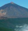
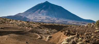
This hike is very tempting, because it takes you almost to the top of Pico de Teide (possibly up to it), guides you through the chaotic terrain of lava flows and makes you acquainted with the incredible landscape of monumental crater of volcano Pico Viejo drowsing on the foot of higher stratovolcanic Teide. There is a cableway leading to this highest peak of Tenerife and the whole Spain and it ends at a height of 3 555 meters asl. Another possible way to get there (except for the alternative ascent to Pico de Teide, for which is necessary a permit) continues with the descent. But its length and terrain is quite challenging. The descent ends at the parking lot at Parador Nacional de las Canadas hotel at an altitude of approximately 2 100 meters asl.
Below the peak of Teide
The starting point of this hike is at the upper cable car station to Pico de Teide. From there, for visitors without ambition for a long walk, leads very well passable approximately half a kilometer long path with good-quality surface from large stones. The surrounding terrain is in some places stained yellow and white and smouldering sulfur vapors tell a lot about the origin of the sleeping mountain, on the slopes of which the path winds. In the south direction is the wall of mountains forming the central edge of caldera with dominating peak of El Sombrero.

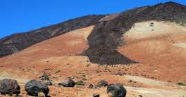
Slope Teide
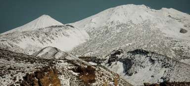
On the other side is a steep slope that ends with the peak of Pico de Teide, 3817 meters asl.

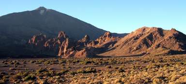
Volcanic hills
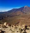
The well walkable path paved with large stones ends after about half a kilometer with an outlook point. There is a nice view of the entire south-west of the island with characteristic peaks of small volcanoes (at least in comparison with the dominant Teide). Completely back is Teno Mountains and below the starting point, from where leads mountain road to the village and gorge Masca – Santiago del Teide.

Solidified lava
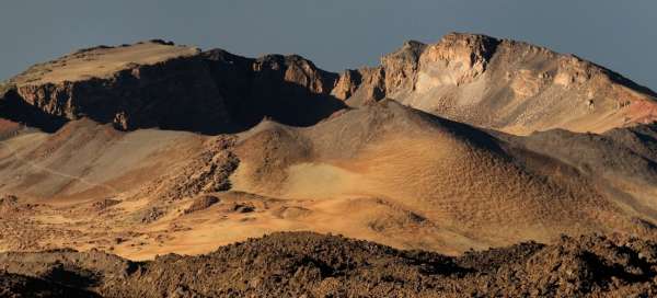
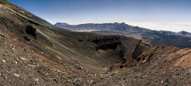
Perhaps the most beautiful view is of the crater of the volcano Pico Viejo, which is intermediate destination of this trek. At this outlook point begins fun in the form of a path in places with chaotic terrain and solidified volcanic lava. Lava stones are pretty sharp, so the caution is advisable. However, if the path is covered with snow, there is high likelihood that you will soon lose your way in this terrain.

The edge of the crater
On the southeast side of the crater is clearly visible the access path leading to its border. This „hole into the ground“ can be partially bypassed, or you can very carefully descend inside.

In the middle of lava
The way through solidified lava terrain is not very fast and seems endless. Fortunately, there is always something to watch.

Pico de Teide
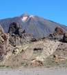
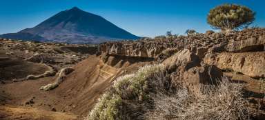
Before the ascent to the edge of Pico Viejo is a nice upland plateau, where you can take a break from caution and attention that was necessary during walking across the lava field. It's time to stop and pay attention for example to Teide. On the slope is clearly visible the ascent route. It is open from 9–16h, permit is valid to a specific time of entry.

Pico Viejo
There are several signposts on the upland plateau. You can continue with the descent to the Nostrils Teide. We, however, choose the turning to the right to the edge of a large crater. After a short ascent there is truly monumental view at this wonder of nature. It depends on time we want or can devote to this place. It is possible to partially bypass the crater, or with caution (free terrain) descend inside (it's really amazing). After a short return back to signposts we choose the descend path to hotel Parador Nacional.

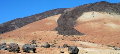
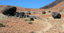
Volcanic egg
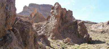
The way then continues to struggle through the countryside, where succulent vegetation are followed by separate lava fields. Very interesting formations are big volcanic boulders (in local material called lava eggs).

Below the volcano
It is almost impossible to see the path in the terrain. The terrain is very rugged. But it almost miraculously appears in front of you during the descent.

Path
On the other hand, the hike is very easy in some sections. This is useful, because there is not much time left and bus is not waiting. There is only one bus line running to the central caldera in the morning from Puerto de la Cruz and it returns back in the afternoon around 16:00. Up-to-date times can be found on the website of local carrier TITSA.

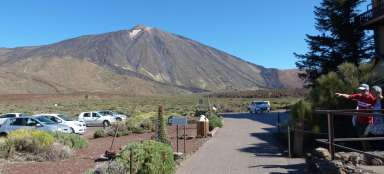
Guajara
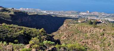
Now is the destination almost within reach. Below distinctive outlook peak Guajara cowers already from this distance small building of hotel Parador Nacional, from where leaves the above mentioned bus or you can hitchhike or walk for three-kilometer. Guajara definitely deserves a separate day for the ascent. From there is probably the best view of the entire central caldera with a dominating stratovolcano. And it's also a great acclimatization peak after the arrival at Tenerife.

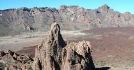
Roques de Garcia
Although you may not have met a living soul during the whole previous journey, there may be quite crowds around the rock formations Roques de Garcia. This is due to the easy access of this place by car or coaches. For us it is a sign that today's journey is coming to an end.

Articles nearby


Giga List: The most beautiful hikes in the world
In this overview you will find a very beautiful, the maximum one-day hikes from around the world. Not only during long treks, but… continue reading
Giga List: The most beautiful tours in Tenerife
Tenerife is famous for its beautiful nature. Outside the volcanic center with the mighty Pico de Teide, you will find huge cliffs… continue reading
Giga List: The most beautiful hikes in the Canary Islands
The Canary Islands offer a variety of beautiful tours not only in the volcanic landscape, but also in the misty forests or along… continue reading
Giga List: The most beautiful hikes in Teide National Park
The whole center of the island of Tenerife is occupied by an inhospitable volcanic caldera from which rises the highest mountain… continue reading
Mohutný kráter Pico Viejo; zajímavé skalní útvary po cestě; rozmanitý povrch od písečné cestičky přes lávový štěrk či nepříliš stabilní suť balvanů až po rovné pláty ztuhlé lávy