Ascent to Ice Lake
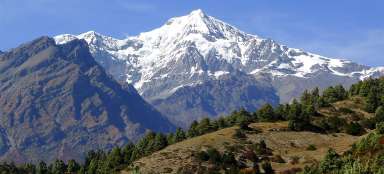
Lake with magnificent views of the Annapuren massif


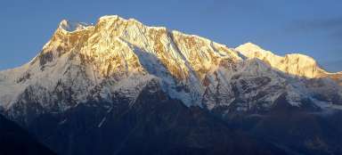
The ascent to Ice Lake (4,600 m above sea level) (Kicho tal) is one of the acclimatization tours in the Annapurna region before the crossing of the Thorong La saddle. From the lake there are wonderful views of the 7,000-meter Annapurna II, III, IV and Gangapurna. The trek is quite demanding due to the large elevation gain of 1200 meters, which must be completed both up and down.
Ascent route to the lake
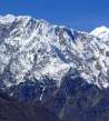
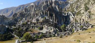
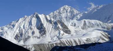
The hiking trail to Ice Lake, marked by blue and white signs, like all side treks, starts right on Brace's main street. It continues through the original, unspoiled by tourism, part of the village. The road leads almost constantly to a very steep hill on stone paths, which are often created by local ruminants rather than tourists. When you catch your breath here, you have the opportunity to enjoy the magnificent views of almost the entire Annapuren massif, which becomes more and more powerful and imposing to the entire valley of the Marsyangdi River.
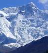
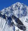
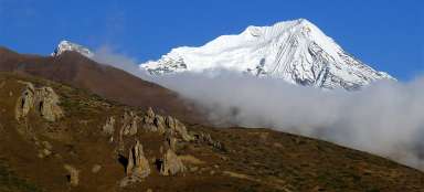
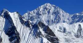
View of Annapurna II (middle) and Annapurna IV (right)
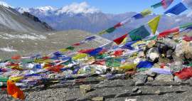
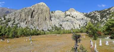
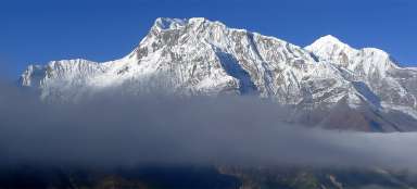
About two-thirds of the ascent to the lake is a view of the valley and the surrounding mountains with a few tens of meters long wall formed only by prayer flags, from where the views are really breathtaking.

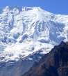
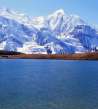
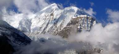
View of Annapurna III (left) and Gangapurna (right)
It is therefore an ideal place to relax before the next climb.

Almost at the top
In addition to the more famous, larger and higher-lying Ice Lake, about 10 minutes before the top of the ascent there is another smaller lake, which resembles a larger puddle than a lake, but the combination of water and mountains looks beautiful.

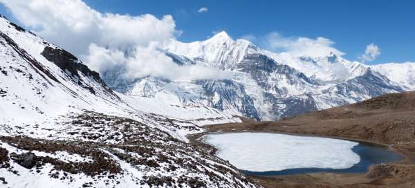
Reaching Ice Lake
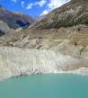
The lake, which, as expected and named, holds frost and ice in its clutches for most of the year, spreads on a plateau surrounded on three sides by the surrounding four to petitive peaks.

Gompa in front of the lake
From the fourth side, the plateau opens directly to Annapurna III. In front of the lake on the edge of the plateau stands majestically a gompa with fluttering lungts.

View from the surrounding hills
From the hills above the lake there are incredible views of the lake together with the Himalayan giants, which gradually cover the clouds during the day.

When to start the ascent
At the beginning of the ascent, 6 o'clock in the morning is recommended. If you get up and keep this time, you will have a unique opportunity to enjoy a lake about 4 hours and 1,200 meters away, almost without people. The way up and down leads along the same path, on which there is no possibility to replenish fluid supplies anywhere. The only source of water is located at the top in the form of a tributary to the lake. So it is not good to underestimate fluids.
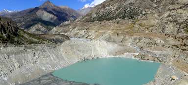
Descent to Braky
On the descent you can enjoy the valley of the Marsyangdi River, in which the tourist center of this area is located, the town of Manang, on the edge of which water melts from the glacier on the wall of Gangapurna glacial lake Gangapurna Tal

Articles nearby


Giga List: The most beautiful side hikes around Annapurna
The circuit around Annapurna is one of the most famous Himalayan treks. In addition to the classic itinerary, you can make a… continue reading
Giga List: The most beautiful stages of the Annapuren trek
The trek around Annapuren is considered one of the most beautiful in Nepal, or in the whole of Asia. It is also due to the fact… continue reading