Tupiza and the surrounding area Hiking
Do you have anything to say about this? Don't hesitate and write your information and experience to help other travelers.
Hiking circuits & Trekking
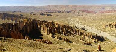
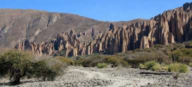
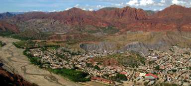
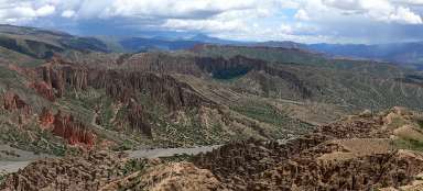
Western canyons: To the west of the city center stretches in a north-south direction about 25 kilometers long red ridge. It is interrupted in several places by river canyons. These canyons are a major tourist destination. The most classic hike is the Inca Canyon. You can also visit the southern canyon of Duende Quebrada Palala: northwest of the city is the wide valley of Quebrada Palala (in the direction of the road leading to the Altiplano). Here you will find the most rock towers. Eastern ridge: directly to the east is another, smaller red rocky ridge. It is famous mainly for its beautiful views of the city (morning) Cerro Elefante: the only valley leading through the eastern ridge you get to the ascent path leading to the mountain Cerro Elefante. El Toroyoj area: The Quebec Seca valley leads southwest from Tupiza, which is interesting mainly in the places where the Toroyoj rock formation flows and the San Juan de Oro river flows.
Difficulty of hiking trails
Hikes around Tupiza are not difficult to elevate. However, count on the number of kilometers, especially if you go on a day trip and want to explore more distant valleys. .
Maps and orientation in the landscape
In the vicinity of Tupiza, most tourists hike along their own axis equipped with only a simple sketch, which is not a problem to find in any traveler in Tupiza. Here it wants a bit of a sense of direction, or not to go too far from the city.